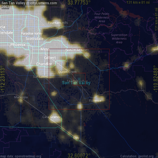
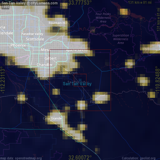
San Tan Valley night lights from space
Night Light of San Tan Valley (Arizona) from space (United States) Src. Average luminocity for 10x10km area is 26.4476% and for 50x50km: 23.7322%.

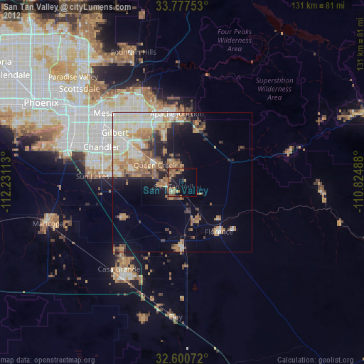
Analysis of San Tan Valley night lights 2016
Square area 10x10 km:
 0.52%
0.52%90-99
0.17%80-89
0.7%70-79
4.37%60-69
10.84%50-59
9.97%40-49
4.55%30-39
3.32%20-29
9.44%10-19
19.93%0-9
36.19%Square area 50x50 km:
4.36%90-99
6.06%80-89
2.66%70-79
3.53%60-69
4%50-59
2.8%40-49
2.39%30-39
2.33%20-29
3.3%10-19
5.77%0-9
62.8%Clear (daylight) street map image can be seen on geolist.org.
Map coordinates:
33° 46' 39.1" North, 112° 13' 52.1" West
33° 11' 28" North, 111° 31' 40.8" West
32° 36' 2.6" North, 110° 49' 29.6" West
Some cities around San Tan Valley sort by population:
• Chandler
31.8 km =19.8 mi,  293°
293°
• Gilbert
30.2 km =18.8 mi,  306°
306°
• Apache Junction
25 km =15.5 mi,  355°
355°
• Queen Creek
11.8 km =7.3 mi,  302°
302°
• Florence
22.1 km =13.7 mi,  143°
143°
• Coolidge
23.7 km =14.7 mi,  177°
177°
• Gold Camp
23.7 km =14.7 mi,  61°
61°
• Gold Canyon
21.8 km =13.5 mi,  22°
22°
7310164 (p: 81,321)
Sources (retrieved 2019-11-25):
» NASA, Earths city lights 1995
» NASA city lights 2003
» Earth at Night: Flat Maps 2012, 2016