Salamanca night lights from space
Night Light of Salamanca (New York) from space (United States) Src. Average luminocity for 10x10km area is 9.2348% and for 50x50km: 2.3089%.
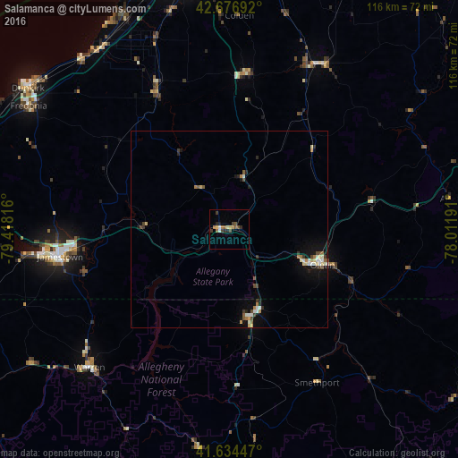
Analysis of Salamanca night lights 2016
Square area 10x10 km:
 0.15%
0.15%90-99
1.06%80-89
0.61%70-79
1.52%60-69
2.12%50-59
1.97%40-49
2.12%30-39
1.52%20-29
2.42%10-19
0.45%0-9
86.06%Square area 50x50 km:
0.18%90-99
0.43%80-89
0.3%70-79
0.2%60-69
0.35%50-59
0.27%40-49
0.36%30-39
0.38%20-29
0.32%10-19
1.39%0-9
95.82%Clear (daylight) street map image can be seen on geolist.org.
Map coordinates:
42° 40' 36.9" North, 79° 25' 5.4" West
42° 9' 28.2" North, 78° 42' 54.1" West
41° 38' 4.1" North, 78° 0' 42.9" West
Some cities around Salamanca sort by population:
• Jamestown
43.4 km =27 mi,  261°
261°
• Olean
25.2 km =15.7 mi,  110°
110°
• Dunkirk
62.2 km =38.6 mi,  305°
305°
• Fredonia
59.6 km =37 mi,  301°
301°
• Hamburg
62.8 km =39 mi,  351°
351°
• Warren
49.8 km =30.9 mi,  225°
225°
• Bradford
23.2 km =14.4 mi,  165°
165°
• Boston
52.4 km =32.6 mi,  357°
357°
5136088 (p: 5,586)
Sources (retrieved 2019-11-25):
» Earth at Night: Flat Maps 2012, 2016