North Mankato night lights from space
Night Light of North Mankato (Minnesota) from space (United States) Src. Average luminocity for 10x10km area is 50.4682% and for 50x50km: 4.9748%.
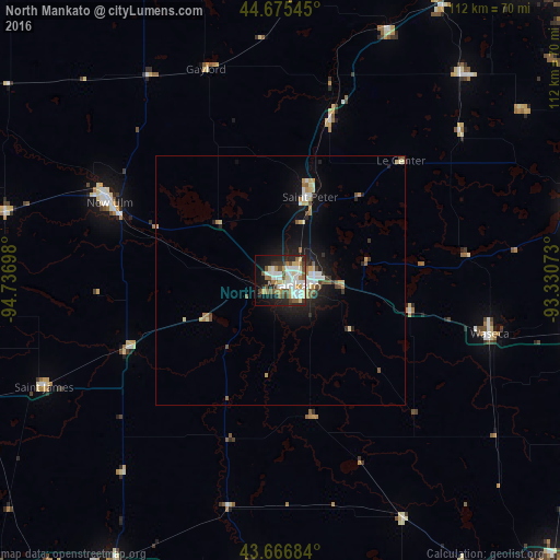
Analysis of North Mankato night lights 2016
Square area 10x10 km:
 12.73%
90-99
11.67%80-89
6.06%70-79
4.09%60-69
5.76%50-59
6.67%40-49
5.91%30-39
5.91%20-29
13.79%10-19
16.52%0-9
10.91%Square area 50x50 km:
0.81%90-99
0.83%80-89
0.65%70-79
0.51%60-69
0.48%50-59
0.7%40-49
0.51%30-39
0.5%20-29
1.34%10-19
3.57%0-9
90.09%Clear (daylight) street map image can be seen on geolist.org.
Map coordinates:
44° 40' 31.6" North, 94° 44' 13.1" West
44° 10' 23.9" North, 94° 2' 1.9" West
43° 40' 0.6" North, 93° 19' 50.6" West
Some cities around North Mankato sort by population:
• Mankato
2.5 km =1.6 mi,  128°
128°
• Faribault
62.4 km =38.8 mi,  77°
77°
• New Ulm
37.3 km =23.2 mi,  294°
294°
• Saint Peter
17.8 km =11.1 mi,  19°
19°
• Waseca
43.3 km =26.9 mi,  104°
104°
• New Prague
54.9 km =34.1 mi,  41°
41°
• Belle Plaine
54.2 km =33.7 mi, 22°
• Jordan
63.7 km =39.6 mi,  30°
30°
5039537 (p: 13,529)
Sources (retrieved 2019-11-25):
» Earth at Night: Flat Maps 2012, 2016