Rome night lights from space
Night Light of Rome (Georgia) from space (United States) Src. Average luminocity for 10x10km area is 72.3187% and for 50x50km: 13.3089%.
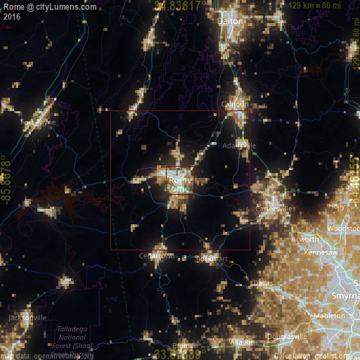
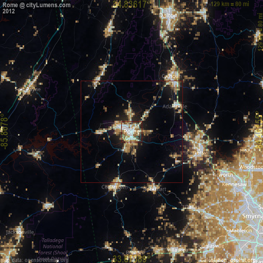
Analysis of Rome night lights 2016
Square area 10x10 km:
 14.47%
90-99
18.86%80-89
13.55%70-79
7.69%60-69
12.09%50-59
13%40-49
9.16%30-39
7.14%20-29
3.85%10-19
0.18%0-9
0%Square area 50x50 km:
1.1%90-99
1.29%80-89
2.03%70-79
2.15%60-69
2.08%50-59
2.19%40-49
1.57%30-39
2.72%20-29
3.25%10-19
9.81%0-9
71.8%Clear (daylight) street map image can be seen on geolist.org.
Map coordinates:
34° 50' 10.2" North, 85° 52' 4.1" West
34° 15' 25.3" North, 85° 9' 52.8" West
33° 40' 26" North, 84° 27' 41.6" West
Some cities around Rome sort by population:
• Kennesaw
56.8 km =35.3 mi,  117°
117°
• Acworth
49.5 km =30.8 mi, 115°
• Cartersville
34.8 km =21.6 mi,  107°
107°
• Calhoun
33.6 km =20.9 mi,  35°
35°
• Fort Payne
55 km =34.2 mi,  292°
292°
• Dallas
47.6 km =29.6 mi,  141°
141°
• Cedartown
28.6 km =17.8 mi,  197°
197°
• LaFayette
50.9 km =31.6 mi,  347°
347°
4219762 (p: 36,323)
Sources (retrieved 2019-11-25):
» Earth at Night: Flat Maps 2012, 2016