Rogers night lights from space
Night Light of Rogers (Arkansas) from space (United States) Src. Average luminocity for 10x10km area is 62.75% and for 50x50km: 20.8225%.
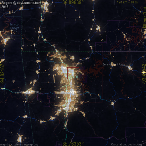
Analysis of Rogers night lights 2016
Square area 10x10 km:
 8.22%
8.22%90-99
12.06%80-89
9.09%70-79
11.71%60-69
14.69%50-59
10.31%40-49
11.89%30-39
11.01%20-29
6.47%10-19
4.55%0-9
0%Square area 50x50 km:
2.09%90-99
2.7%80-89
2.99%70-79
2.83%60-69
4.1%50-59
3.92%40-49
3.79%30-39
5.36%20-29
5.47%10-19
8.14%0-9
58.61%Clear (daylight) street map image can be seen on geolist.org.
Map coordinates:
36° 53' 47" North, 94° 49' 18" West
36° 19' 55.3" North, 94° 7' 6.7" West
35° 45' 48.7" North, 93° 24' 55.5" West
Some cities around Rogers sort by population:
• Fayetteville
30.2 km =18.8 mi,  186°
186°
• Springdale
16.2 km =10.1 mi,  183°
183°
• Bentonville
9.3 km =5.8 mi,  299°
299°
• Bella Vista
21.5 km =13.4 mi,  320°
320°
• Centerton
15.2 km =9.4 mi,  281°
281°
• Lowell
8.6 km =5.3 mi, 187°
• Farmington
34.2 km =21.3 mi,  199°
199°
• Pea Ridge
13.6 km =8.5 mi,  1°
1°
4128894 (p: 63,159)
Sources (retrieved 2019-11-25):
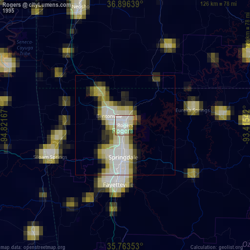
» NASA, Earths city lights 1995
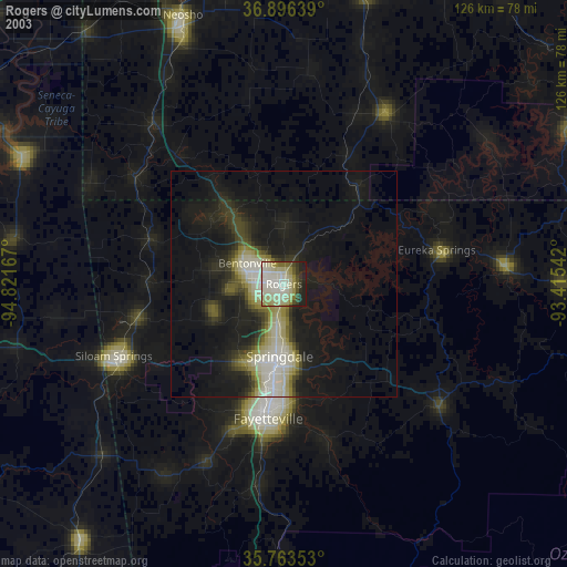
» NASA city lights 2003
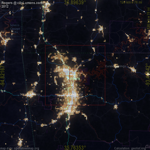
» Earth at Night: Flat Maps 2012, 2016