Pea Ridge night lights from space
Night Light of Pea Ridge (Arkansas) from space (United States) Src. Average luminocity for 10x10km area is 16.4231% and for 50x50km: 14.599%.
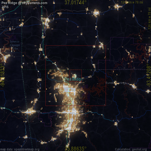
Analysis of Pea Ridge night lights 2016
Square area 10x10 km:
 0.18%
0.18%90-99
2.01%80-89
2.56%70-79
1.1%60-69
1.47%50-59
1.47%40-49
0.55%30-39
7.51%20-29
3.3%10-19
26.74%0-9
53.11%Square area 50x50 km:
1.17%90-99
1.74%80-89
2.18%70-79
2.05%60-69
2.54%50-59
2.78%40-49
2.65%30-39
4.23%20-29
4.18%10-19
6.45%0-9
70.03%Clear (daylight) street map image can be seen on geolist.org.
Map coordinates:
37° 1' 2.8" North, 94° 49' 6" West
36° 27' 14.3" North, 94° 6' 54.7" West
35° 53' 10.9" North, 93° 24' 43.5" West
Some cities around Pea Ridge sort by population:
• Fayetteville
43.7 km =27.2 mi,  184°
184°
• Springdale
29.7 km =18.5 mi, 182°
• Rogers
13.6 km =8.5 mi, 181°
• Bentonville
12.3 km =7.6 mi,  222°
222°
• Bella Vista
14.3 km =8.9 mi,  282°
282°
• Centerton
18.5 km =11.5 mi,  235°
235°
• Lowell
22.1 km =13.7 mi, 183°
• Farmington
47.3 km =29.4 mi,  194°
194°
4125681 (p: 5,242)
Sources (retrieved 2019-11-25):
» Earth at Night: Flat Maps 2012, 2016