Ringwood night lights from space
Night Light of Ringwood (New Jersey) from space (United States) Src. Average luminocity for 10x10km area is 18.112% and for 50x50km: 35.6322%.
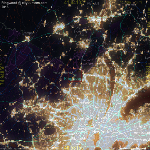
Analysis of Ringwood night lights 2016
Square area 10x10 km:
 0.49%
0.49%90-99
0.16%80-89
0.97%70-79
1.46%60-69
3.25%50-59
1.62%40-49
5.03%30-39
3.08%20-29
13.31%10-19
28.57%0-9
42.05%Square area 50x50 km:
5.73%90-99
6.21%80-89
4.17%70-79
6.1%60-69
9.68%50-59
6.53%40-49
3.7%30-39
3.22%20-29
4.98%10-19
7.41%0-9
42.28%Clear (daylight) street map image can be seen on geolist.org.
Map coordinates:
41° 38' 27.7" North, 74° 56' 54.8" West
41° 6' 48.3" North, 74° 14' 43.5" West
40° 34' 53.6" North, 73° 32' 32.3" West
Some cities around Ringwood sort by population:
• West Milford
10.4 km =6.5 mi,  280°
280°
• Mahwah
9 km =5.6 mi,  107°
107°
• Ramsey
10.7 km =6.6 mi,  125°
125°
• Oakland
11.3 km =7 mi,  188°
188°
• Wanaque
9.3 km =5.8 mi,  205°
205°
• Suffern
8 km =5 mi,  88°
88°
• Franklin Lakes
11.3 km =7 mi,  162°
162°
• Airmont
10.9 km =6.8 mi,  97°
97°
5103286 (p: 12,448)
Sources (retrieved 2019-11-25):
» Earth at Night: Flat Maps 2012, 2016