Franklin Lakes night lights from space
Night Light of Franklin Lakes (New Jersey) from space (United States) Src. Average luminocity for 10x10km area is 61.3401% and for 50x50km: 54.8592%.
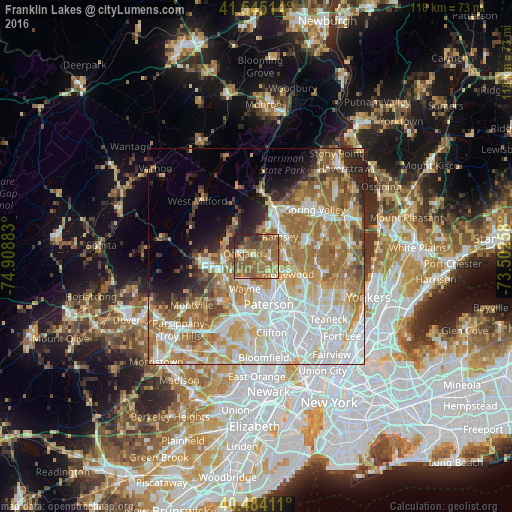
Analysis of Franklin Lakes night lights 2016
Square area 10x10 km:
 2.04%
2.04%90-99
5.1%80-89
7.48%70-79
11.05%60-69
26.36%50-59
32.82%40-49
5.1%30-39
4.59%20-29
5.44%10-19
0%0-9
0%Square area 50x50 km:
14.76%90-99
11.99%80-89
6.28%70-79
8.63%60-69
11.92%50-59
7.23%40-49
3.8%30-39
2.91%20-29
4.84%10-19
4.98%0-9
22.67%Clear (daylight) street map image can be seen on geolist.org.
Map coordinates:
41° 32' 42.5" North, 74° 54' 31.8" West
41° 1' 0.3" North, 74° 12' 20.5" West
40° 29' 2.8" North, 73° 30' 9.3" West
Some cities around Franklin Lakes sort by population:
• Wyckoff
2.9 km =1.8 mi,  106°
106°
• Ramsey
7.1 km =4.4 mi,  50°
50°
• Oakland
4.9 km =3 mi,  265°
265°
• Pompton Lakes
7.2 km =4.5 mi,  259°
259°
• Waldwick
7.4 km =4.6 mi,  95°
95°
• North Haledon
7.1 km =4.4 mi,  166°
166°
• Midland Park
6.3 km =3.9 mi,  119°
119°
• Allendale
7 km =4.3 mi,  66°
66°
5098242 (p: 10,899)
Sources (retrieved 2019-11-25):
» Earth at Night: Flat Maps 2012, 2016