Richland night lights from space
Night Light of Richland (New York) from space (United States) Src. Average luminocity for 10x10km area is 1.2571% and for 50x50km: 0.464%.
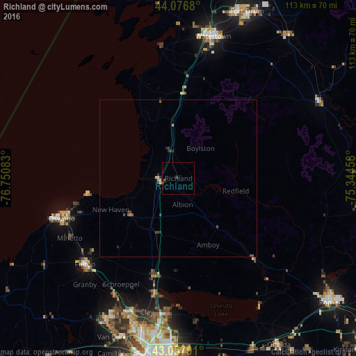
Analysis of Richland night lights 2016
Square area 10x10 km:
 0%
0%90-99
0%80-89
0.32%70-79
0%60-69
0%50-59
0.63%40-49
0%30-39
0.63%20-29
0%10-19
0%0-9
98.41%Square area 50x50 km:
0%90-99
0.04%80-89
0.06%70-79
0.1%60-69
0.02%50-59
0.16%40-49
0.1%30-39
0.15%20-29
0.15%10-19
0.04%0-9
99.18%Clear (daylight) street map image can be seen on geolist.org.
Map coordinates:
44° 4' 36.5" North, 76° 45' 3" West
43° 34' 10.2" North, 76° 2' 51.7" West
43° 3' 28.5" North, 75° 20' 40.5" West
Some cities around Richland sort by population:
• Watertown
46.4 km =28.8 mi,  13°
13°
• Oswego
39.4 km =24.5 mi,  251°
251°
• Fulton
40.5 km =25.2 mi,  227°
227°
• Baldwinsville
51.2 km =31.8 mi,  206°
206°
• North Syracuse
48.8 km =30.3 mi,  187°
187°
• Mattydale
53 km =32.9 mi, 188°
• Solvay
58.3 km =36.2 mi, 192°
• Volney
35.5 km =22.1 mi,  224°
224°
5133799 (p: 5,661)
Sources (retrieved 2019-11-25):
» Earth at Night: Flat Maps 2012, 2016