Richland night lights from space
Night Light of Richland (Washington) from space (United States) Src. Average luminocity for 10x10km area is 57.6577% and for 50x50km: 11.0612%.
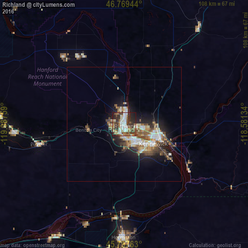
Analysis of Richland night lights 2016
Square area 10x10 km:
 9.97%
9.97%90-99
13.1%80-89
7.59%70-79
6.1%60-69
5.65%50-59
10.42%40-49
10.86%30-39
15.92%20-29
14.43%10-19
5.95%0-9
0%Square area 50x50 km:
1.8%90-99
1.92%80-89
1.25%70-79
1.21%60-69
1.35%50-59
2.07%40-49
1.91%30-39
1.82%20-29
2.77%10-19
5.75%0-9
78.16%Clear (daylight) street map image can be seen on geolist.org.
Map coordinates:
46° 46' 10" North, 119° 59' 15.3" West
46° 17' 8.5" North, 119° 17' 4.1" West
45° 47' 51.5" North, 118° 34' 52.8" West
Some cities around Richland sort by population:
• Kennewick
14 km =8.7 mi,  126°
126°
• Pasco
15 km =9.3 mi,  109°
109°
• Hermiston
49.5 km =30.8 mi,  180°
180°
• West Richland
6.3 km =3.9 mi,  289°
289°
• Grandview
47.6 km =29.6 mi,  265°
265°
• Umatilla
41.2 km =25.6 mi,  186°
186°
• Finley
24.2 km =15 mi, 127°
• Prosser
38.3 km =23.8 mi,  256°
256°
5808276 (p: 54,248)
Sources (retrieved 2019-11-25):
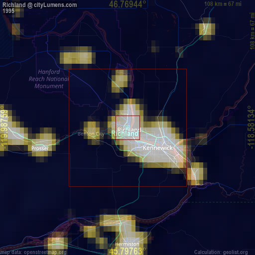
» NASA, Earths city lights 1995
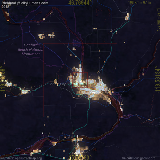
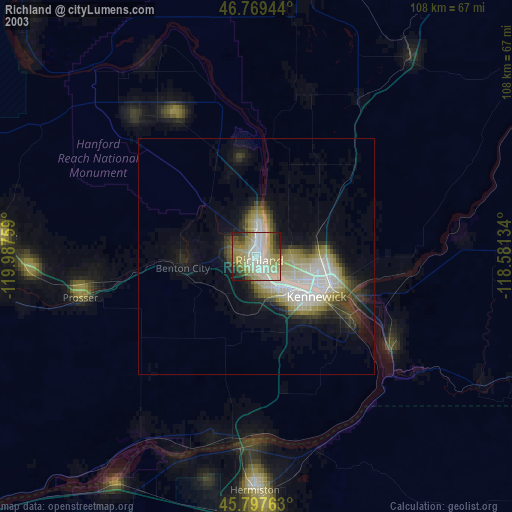
» NASA city lights 2003
» Earth at Night: Flat Maps 2012, 2016