Hermiston night lights from space
Night Light of Hermiston (Oregon) from space (United States) Src. Average luminocity for 10x10km area is 36.1815% and for 50x50km: 2.9828%.
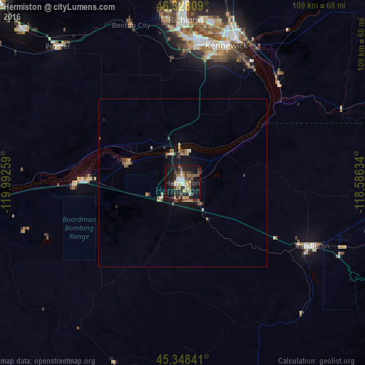
Analysis of Hermiston night lights 2016
Square area 10x10 km:
 3.57%
3.57%90-99
5.36%80-89
4.91%70-79
4.46%60-69
5.21%50-59
5.36%40-49
7.59%30-39
6.4%20-29
9.67%10-19
36.9%0-9
10.57%Square area 50x50 km:
0.16%90-99
0.31%80-89
0.56%70-79
0.32%60-69
0.42%50-59
0.47%40-49
0.58%30-39
0.46%20-29
0.52%10-19
2.83%0-9
93.37%Clear (daylight) street map image can be seen on geolist.org.
Map coordinates:
46° 19' 41.1" North, 119° 59' 33.3" West
45° 50' 25.5" North, 119° 17' 22.1" West
45° 20' 54.3" North, 118° 35' 10.8" West
Some cities around Hermiston sort by population:
• Kennewick
42.9 km =26.7 mi,  15°
15°
• Pasco
46.7 km =29 mi, 18°
• Richland
49.5 km =30.8 mi,  0°
0°
• Pendleton
43.1 km =26.8 mi,  115°
115°
• West Richland
51.9 km =32.2 mi,  353°
353°
• Umatilla
9.5 km =5.9 mi,  334°
334°
• Finley
40.1 km =24.9 mi,  29°
29°
• Prosser
55 km =34.2 mi,  317°
317°
5731070 (p: 17,201)
Sources (retrieved 2019-11-25):
» Earth at Night: Flat Maps 2012, 2016