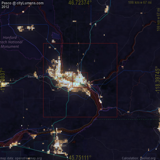
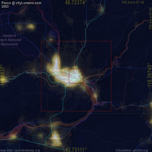
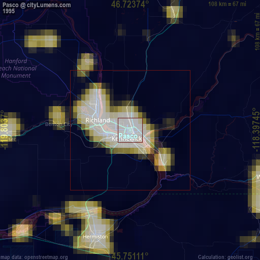
Pasco night lights from space
Night Light of Pasco (Washington) from space (United States) Src. Average luminocity for 10x10km area is 64.8214% and for 50x50km: 11.0891%.
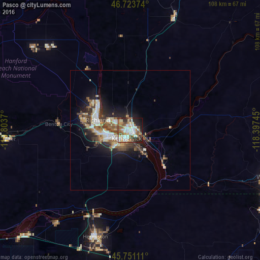
Analysis of Pasco night lights 2016
Square area 10x10 km:
 17.26%
90-99
15.48%80-89
7.14%70-79
8.18%60-69
8.63%50-59
8.93%40-49
8.78%30-39
5.21%20-29
10.57%10-19
9.08%0-9
0.74%Square area 50x50 km:
1.81%90-99
1.93%80-89
1.26%70-79
1.22%60-69
1.37%50-59
2.01%40-49
1.94%30-39
1.76%20-29
2.76%10-19
5.78%0-9
78.16%Clear (daylight) street map image can be seen on geolist.org.
Map coordinates:
46° 43' 25.5" North, 119° 48' 13.3" West
46° 14' 22.5" North, 119° 6' 2.1" West
45° 45' 4" North, 118° 23' 50.8" West
Some cities around Pasco sort by population:
• Kennewick
4.2 km =2.6 mi,  221°
221°
• Richland
15 km =9.3 mi,  289°
289°
• Hermiston
46.7 km =29 mi,  198°
198°
• West Richland
21.3 km =13.2 mi, 289°
• Umatilla
40.4 km =25.1 mi,  207°
207°
• Finley
10.8 km =6.7 mi,  151°
151°
• Prosser
51.5 km =32 mi,  265°
265°
• Connell
50.6 km =31.4 mi,  21°
21°
5806298 (p: 69,451)
Sources (retrieved 2019-11-25):
» NASA, Earths city lights 1995
» NASA city lights 2003
» Earth at Night: Flat Maps 2012, 2016