Red Wing night lights from space
Night Light of Red Wing (Minnesota) from space (United States) Src. Average luminocity for 10x10km area is 23.7955% and for 50x50km: 2.52%.
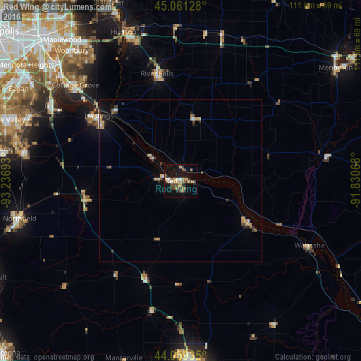
Analysis of Red Wing night lights 2016
Square area 10x10 km:
 1.21%
1.21%90-99
2.42%80-89
4.24%70-79
1.97%60-69
6.21%50-59
3.33%40-49
5.15%30-39
2.12%20-29
2.88%10-19
25.91%0-9
44.55%Square area 50x50 km:
0.2%90-99
0.19%80-89
0.46%70-79
0.29%60-69
0.49%50-59
0.29%40-49
0.38%30-39
0.29%20-29
0.44%10-19
1.77%0-9
95.2%Clear (daylight) street map image can be seen on geolist.org.
Map coordinates:
45° 3' 40.6" North, 93° 14' 12.9" West
44° 33' 44.9" North, 92° 32' 1.7" West
44° 3' 33.7" North, 91° 49' 50.4" West
Some cities around Red Wing sort by population:
• Cottage Grove
43.8 km =27.2 mi,  312°
312°
• Rosemount
50.8 km =31.6 mi,  292°
292°
• Farmington
49 km =30.4 mi,  280°
280°
• Hastings
32.2 km =20 mi, 308°
• River Falls
34 km =21.1 mi,  347°
347°
• Hudson
49.1 km =30.5 mi,  338°
338°
• Saint Paul Park
47.7 km =29.6 mi, 310°
• Lake City
24.5 km =15.2 mi,  120°
120°
5042773 (p: 16,445)
Sources (retrieved 2019-11-25):
» Earth at Night: Flat Maps 2012, 2016