Ravenna night lights from space
Night Light of Ravenna (Ohio) from space (United States) Src. Average luminocity for 10x10km area is 35.4659% and for 50x50km: 28.6918%.
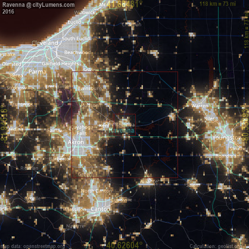
Analysis of Ravenna night lights 2016
Square area 10x10 km:
 1.95%
1.95%90-99
4.22%80-89
4.71%70-79
2.92%60-69
5.52%50-59
8.6%40-49
7.31%30-39
6.98%20-29
18.99%10-19
27.44%0-9
11.36%Square area 50x50 km:
4.07%90-99
4.88%80-89
2.79%70-79
3.49%60-69
6.35%50-59
6.77%40-49
5.51%30-39
3.99%20-29
5.54%10-19
7.24%0-9
49.37%Clear (daylight) street map image can be seen on geolist.org.
Map coordinates:
41° 41' 5.3" North, 81° 56' 42.6" West
41° 9' 27.2" North, 81° 14' 31.4" West
40° 37' 33.7" North, 80° 32' 20.1" West
Some cities around Ravenna sort by population:
• Cuyahoga Falls
20.5 km =12.7 mi,  262°
262°
• Stow
16.6 km =10.3 mi,  270°
270°
• Kent
9.7 km =6 mi, 267°
• Hudson
19 km =11.8 mi,  298°
298°
• Tallmadge
17.9 km =11.1 mi,  249°
249°
• Streetsboro
12.6 km =7.8 mi,  316°
316°
• Aurora
19.8 km =12.3 mi,  334°
334°
• Munroe Falls
16.6 km =10.3 mi, 264°
5167737 (p: 11,619)
Sources (retrieved 2019-11-25):
» Earth at Night: Flat Maps 2012, 2016