Rancho Cucamonga night lights from space
Night Light of Rancho Cucamonga (California) from space (United States) Src. Average luminocity for 10x10km area is 93.5641% and for 50x50km: 54.2636%.
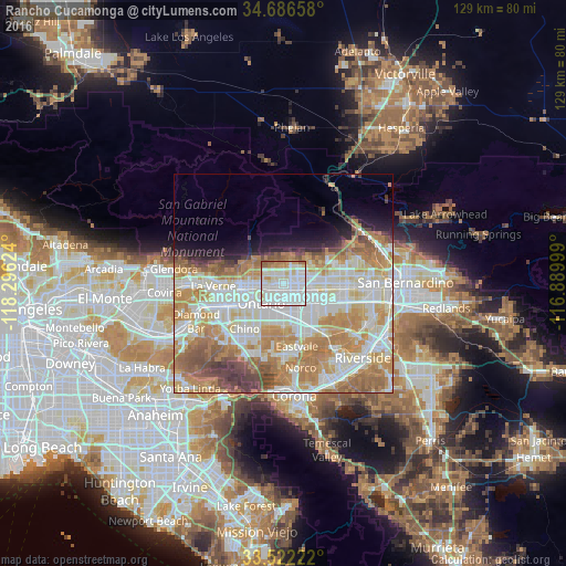
Analysis of Rancho Cucamonga night lights 2016
Square area 10x10 km:
 46.52%
90-99
31.32%80-89
10.44%70-79
3.48%60-69
5.49%50-59
2.75%40-49
0%30-39
0%20-29
0%10-19
0%0-9
0%Square area 50x50 km:
13.93%90-99
13.76%80-89
6.74%70-79
9.49%60-69
11.93%50-59
5.08%40-49
3.61%30-39
1.97%20-29
2.24%10-19
4.19%0-9
27.07%Clear (daylight) street map image can be seen on geolist.org.
Map coordinates:
34° 41' 11.7" North, 118° 17' 46.5" West
34° 6' 23" North, 117° 35' 35.2" West
33° 31' 20" North, 116° 53' 24" West
Some cities around Rancho Cucamonga sort by population:
• Fontana
14.6 km =9.1 mi,  96°
96°
• Ontario
7.2 km =4.5 mi,  228°
228°
• Chino
13.7 km =8.5 mi,  220°
220°
• Upland
5.2 km =3.2 mi,  259°
259°
• Montclair
9.5 km =5.9 mi,  250°
250°
• Claremont
11.7 km =7.3 mi, 264°
• Jurupa Valley
14.5 km =9 mi,  150°
150°
• Glen Avon
14.5 km =9 mi,  136°
136°
5385955 (p: 175,236)
Sources (retrieved 2019-11-25):
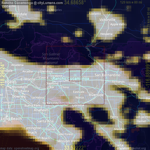
» NASA, Earths city lights 1995
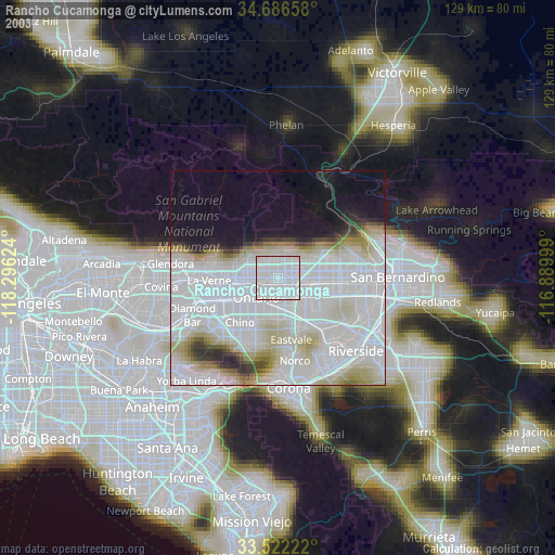
» NASA city lights 2003
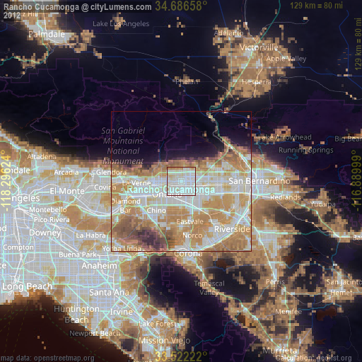
» Earth at Night: Flat Maps 2012, 2016