Preston night lights from space
Night Light of Preston (Idaho) from space (United States) Src. Average luminocity for 10x10km area is 4.547% and for 50x50km: 0.4348%.
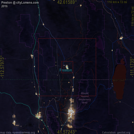
Analysis of Preston night lights 2016
Square area 10x10 km:
 0%
0%90-99
0.61%80-89
0.3%70-79
2.12%60-69
0.45%50-59
0.15%40-49
0%30-39
1.82%20-29
1.36%10-19
1.06%0-9
92.12%Square area 50x50 km:
0%90-99
0.03%80-89
0.01%70-79
0.14%60-69
0.09%50-59
0.04%40-49
0.12%30-39
0.13%20-29
0.19%10-19
0.07%0-9
99.19%Clear (daylight) street map image can be seen on geolist.org.
Map coordinates:
42° 36' 57.2" North, 112° 34' 47.1" West
42° 5' 46.7" North, 111° 52' 35.8" West
41° 34' 20.7" North, 111° 10' 24.6" West
Some cities around Preston sort by population:
• Logan
40.3 km =25 mi,  175°
175°
• Brigham City
66.2 km =41.1 mi,  190°
190°
• Smithfield
28.9 km =18 mi,  172°
172°
• North Logan
36.8 km =22.9 mi, 170°
• Tremonton
49 km =30.4 mi,  209°
209°
• Hyrum
51.4 km =31.9 mi, 177°
• Providence
43.6 km =27.1 mi, 173°
• Nibley
47.1 km =29.3 mi, 175°
5604473 (p: 5,212)
Sources (retrieved 2019-11-25):
» Earth at Night: Flat Maps 2012, 2016