Logan night lights from space
Night Light of Logan (Utah) from space (United States) Src. Average luminocity for 10x10km area is 44.9302% and for 50x50km: 4.053%.
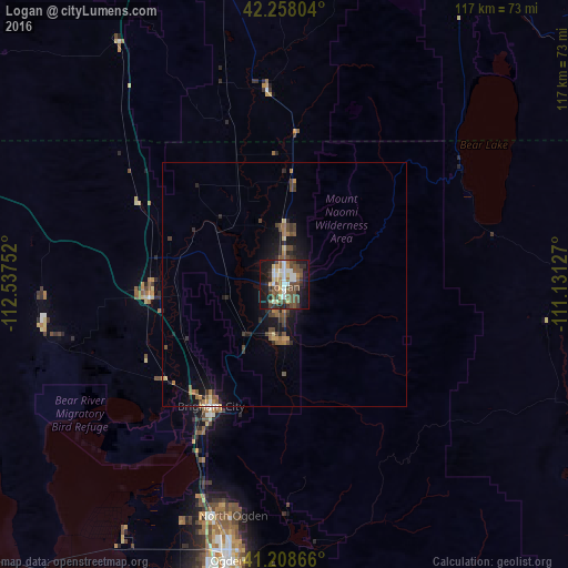
Analysis of Logan night lights 2016
Square area 10x10 km:
 6.98%
6.98%90-99
7.31%80-89
5.19%70-79
5.03%60-69
3.9%50-59
9.25%40-49
14.12%30-39
8.12%20-29
8.44%10-19
29.38%0-9
2.27%Square area 50x50 km:
0.32%90-99
0.33%80-89
0.37%70-79
0.43%60-69
0.59%50-59
0.79%40-49
1.25%30-39
0.75%20-29
1.03%10-19
3.29%0-9
90.84%Clear (daylight) street map image can be seen on geolist.org.
Map coordinates:
42° 15' 28.9" North, 112° 32' 15.1" West
41° 44' 7.8" North, 111° 50' 3.8" West
41° 12' 31.2" North, 111° 7' 52.6" West
Some cities around Logan sort by population:
• Brigham City
29.2 km =18.1 mi,  211°
211°
• Smithfield
11.4 km =7.1 mi,  0°
0°
• North Logan
4.5 km =2.8 mi,  33°
33°
• Tremonton
27.6 km =17.1 mi,  264°
264°
• Hyrum
11.4 km =7.1 mi,  187°
187°
• Providence
3.5 km =2.2 mi,  156°
156°
• Nibley
6.8 km =4.2 mi,  179°
179°
• Preston
40.3 km =25 mi,  355°
355°
5777544 (p: 50,371)
Sources (retrieved 2019-11-25):
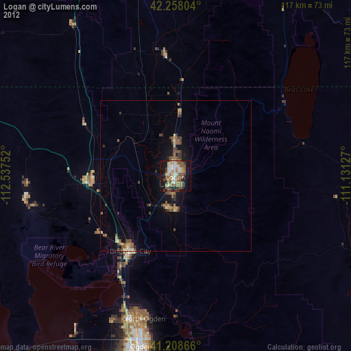
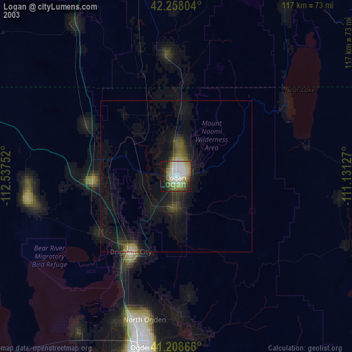
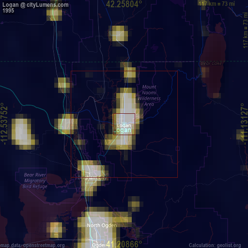
» NASA, Earths city lights 1995
» NASA city lights 2003
» Earth at Night: Flat Maps 2012, 2016