Pollock Pines night lights from space
Night Light of Pollock Pines (California) from space (United States) Src. Average luminocity for 10x10km area is 0.7568% and for 50x50km: 1.1305%.
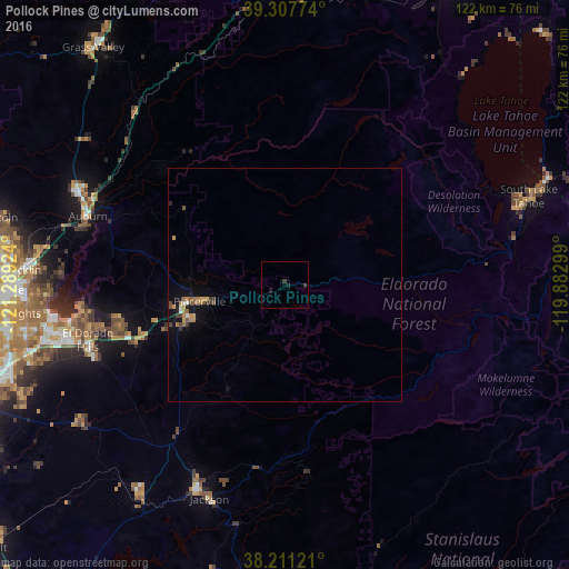
Analysis of Pollock Pines night lights 2016
Square area 10x10 km:
 0%
0%90-99
0%80-89
0%70-79
0%60-69
0%50-59
0%40-49
0%30-39
1.36%20-29
0%10-19
1.36%0-9
97.28%Square area 50x50 km:
0.07%90-99
0.07%80-89
0.03%70-79
0.3%60-69
0.27%50-59
0.16%40-49
0.15%30-39
0.28%20-29
0.08%10-19
0.94%0-9
97.66%Clear (daylight) street map image can be seen on geolist.org.
Map coordinates:
39° 18' 27.9" North, 121° 17' 21.3" West
38° 45' 41.7" North, 120° 35' 10" West
38° 12' 40.4" North, 119° 52' 58.8" West
Some cities around Pollock Pines sort by population:
• Folsom
52 km =32.3 mi,  259°
259°
• El Dorado Hills
43.9 km =27.3 mi, 258°
• Granite Bay
50.1 km =31.1 mi,  270°
270°
• Cameron Park
36.3 km =22.6 mi,  253°
253°
• Auburn
45.1 km =28 mi,  289°
289°
• North Auburn
46.9 km =29.1 mi, 293°
• Diamond Springs
21.2 km =13.2 mi, 249°
• Placerville
18.8 km =11.7 mi, 259°
5384133 (p: 6,871)
Sources (retrieved 2019-11-25):
» Earth at Night: Flat Maps 2012, 2016