Plano night lights from space
Night Light of Plano (Texas) from space (United States) Src. Average luminocity for 10x10km area is 95.1667% and for 50x50km: 76.9235%.
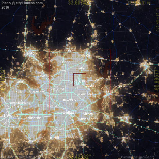
Analysis of Plano night lights 2016
Square area 10x10 km:
 41.39%
90-99
39.19%80-89
12.27%70-79
6.78%60-69
0.37%50-59
0%40-49
0%30-39
0%20-29
0%10-19
0%0-9
0%Square area 50x50 km:
28.93%90-99
23.08%80-89
9.12%70-79
7.68%60-69
7.25%50-59
5.44%40-49
3.5%30-39
4.66%20-29
2.72%10-19
3.42%0-9
4.21%Clear (daylight) street map image can be seen on geolist.org.
Map coordinates:
33° 36' 26.7" North, 97° 24' 7.3" West
33° 1' 11.4" North, 96° 41' 56" West
32° 25' 42" North, 95° 59' 44.8" West
Some cities around Plano sort by population:
• Garland
13.2 km =8.2 mi,  154°
154°
• Richardson
8.5 km =5.3 mi,  199°
199°
• Allen
9.6 km =6 mi,  15°
15°
• Wylie
14.9 km =9.3 mi,  92°
92°
• Sachse
10.8 km =6.7 mi,  116°
116°
• Murphy
8 km =5 mi, 93°
• Addison
13.8 km =8.6 mi,  242°
242°
• Lucas
13.5 km =8.4 mi,  57°
57°
4719457 (p: 283,558)
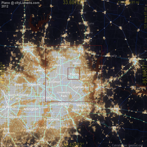
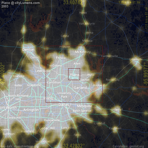
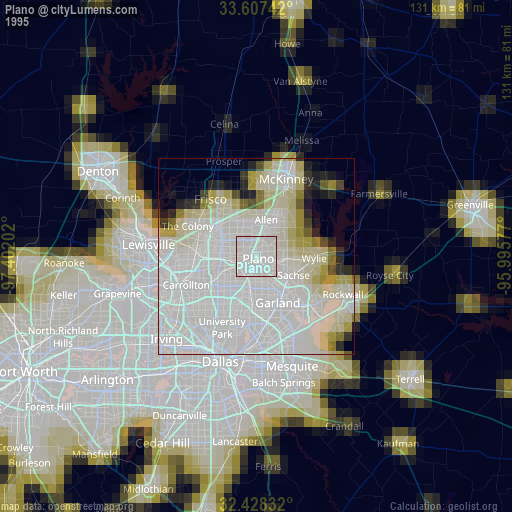
Sources (retrieved 2019-11-25):
» NASA, Earths city lights 1995
» NASA city lights 2003
» Earth at Night: Flat Maps 2012, 2016