Parkville night lights from space
Night Light of Parkville (Maryland) from space (United States) Src. Average luminocity for 10x10km area is 94.3146% and for 50x50km: 53.8666%.
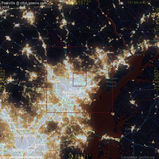

Analysis of Parkville night lights 2016
Square area 10x10 km:
 51.02%
90-99
28.4%80-89
10.37%70-79
4.42%60-69
5.27%50-59
0.51%40-49
0%30-39
0%20-29
0%10-19
0%0-9
0%Square area 50x50 km:
17.4%90-99
12.35%80-89
5.87%70-79
6.66%60-69
6.42%50-59
5.67%40-49
5.51%30-39
5.05%20-29
6.4%10-19
8.03%0-9
20.63%Clear (daylight) street map image can be seen on geolist.org.
Map coordinates:
39° 55' 7.4" North, 77° 14' 34.2" West
39° 22' 38.4" North, 76° 32' 22.9" West
38° 49' 54.2" North, 75° 50' 11.7" West
Some cities around Parkville sort by population:
• Towson
6 km =3.7 mi,  296°
296°
• Carney
2.3 km =1.4 mi,  36°
36°
• Perry Hall
7.6 km =4.7 mi,  59°
59°
• Rosedale
6.7 km =4.2 mi,  161°
161°
• Rossville
6.7 km =4.2 mi,  129°
129°
• Overlea
2.3 km =1.4 mi, 133°
• Charles Village
8.7 km =5.4 mi,  226°
226°
• Hampton
6.4 km =4 mi,  322°
322°
4364946 (p: 30,734)
Sources (retrieved 2019-11-25):
» Earth at Night: Flat Maps 2012, 2016