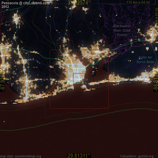
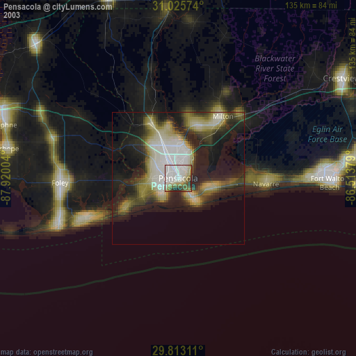
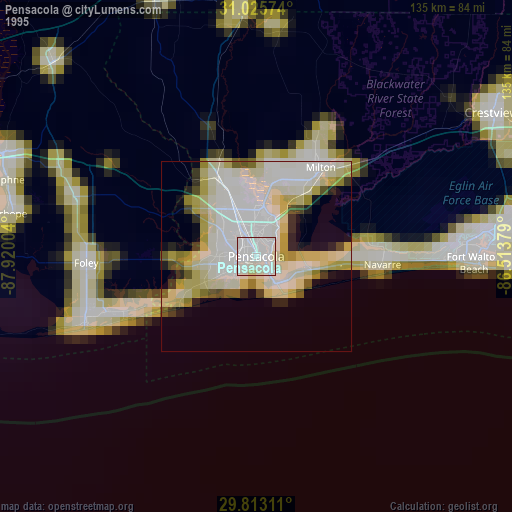
Pensacola night lights from space
Night Light of Pensacola (Florida) from space (United States) Src. Average luminocity for 10x10km area is 75.3626% and for 50x50km: 29.5473%.

Analysis of Pensacola night lights 2016
Square area 10x10 km:
 28.75%
90-99
24.91%80-89
6.04%70-79
7.51%60-69
2.38%50-59
2.38%40-49
4.95%30-39
10.99%20-29
11.72%10-19
0.37%0-9
0%Square area 50x50 km:
4.43%90-99
4.38%80-89
5.33%70-79
5.52%60-69
5.72%50-59
1.95%40-49
3.33%30-39
4.5%20-29
7.17%10-19
14.22%0-9
43.45%Clear (daylight) street map image can be seen on geolist.org.
Map coordinates:
31° 1' 32.7" North, 87° 55' 12.1" West
30° 25' 16.7" North, 87° 13' 0.9" West
29° 48' 47.2" North, 86° 30' 49.6" West
Some cities around Pensacola sort by population:
• East Pensacola Heights
3.6 km =2.2 mi,  76°
76°
• Ferry Pass
9.9 km =6.2 mi,  2°
2°
• Bellview
10.4 km =6.5 mi,  295°
295°
• Brent
5.6 km =3.5 mi,  340°
340°
• West Pensacola
6 km =3.7 mi,  275°
275°
• Myrtle Grove
8.7 km =5.4 mi,  269°
269°
• Warrington
6.9 km =4.3 mi,  233°
233°
• Gulf Breeze
8.8 km =5.5 mi,  144°
144°
4168228 (p: 53,193)
Sources (retrieved 2019-11-25):
» NASA, Earths city lights 1995
» NASA city lights 2003
» Earth at Night: Flat Maps 2012, 2016