Gulf Breeze night lights from space
Night Light of Gulf Breeze (Florida) from space (United States) Src. Average luminocity for 10x10km area is 31.0256% and for 50x50km: 23.195%.
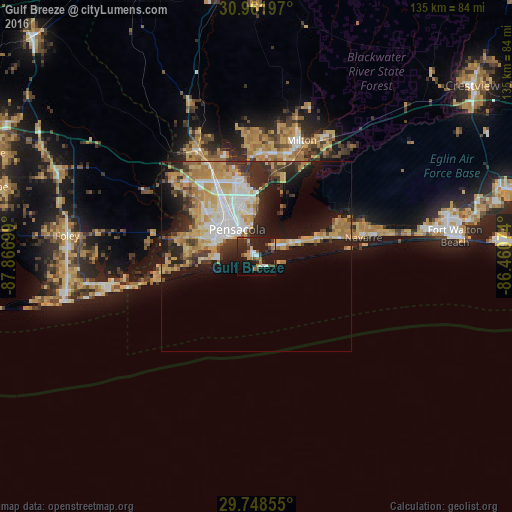
Analysis of Gulf Breeze night lights 2016
Square area 10x10 km:
 3.85%
3.85%90-99
2.38%80-89
2.93%70-79
4.21%60-69
4.95%50-59
2.56%40-49
5.49%30-39
6.96%20-29
15.75%10-19
35.9%0-9
15.02%Square area 50x50 km:
3.97%90-99
3.76%80-89
4.23%70-79
4.12%60-69
3.71%50-59
1.2%40-49
2.28%30-39
3.35%20-29
5.68%10-19
12.13%0-9
55.59%Clear (daylight) street map image can be seen on geolist.org.
Map coordinates:
30° 57' 43.1" North, 87° 52' 1.2" West
30° 21' 25.7" North, 87° 9' 49.9" West
29° 44' 54.8" North, 86° 27' 38.7" West
Some cities around Gulf Breeze sort by population:
• East Pensacola Heights
8.1 km =5 mi,  349°
349°
• Pensacola
8.8 km =5.5 mi,  324°
324°
• Ferry Pass
17.6 km =10.9 mi,  344°
344°
• Brent
14.2 km =8.8 mi,  330°
330°
• West Pensacola
13.5 km =8.4 mi,  304°
304°
• Midway
16.1 km =10 mi,  70°
70°
• Myrtle Grove
15.5 km =9.6 mi, 297°
• Warrington
11.1 km =6.9 mi,  285°
285°
4157634 (p: 6,323)
Sources (retrieved 2019-11-25):
» Earth at Night: Flat Maps 2012, 2016