Elsmere night lights from space
Night Light of Elsmere (Delaware) from space (United States) Src. Average luminocity for 10x10km area is 89.3864% and for 50x50km: 45.4867%.
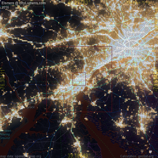
Analysis of Elsmere night lights 2016
Square area 10x10 km:
 34.42%
90-99
33.28%80-89
10.23%70-79
9.09%60-69
6.33%50-59
2.92%40-49
2.11%30-39
1.62%20-29
0%10-19
0%0-9
0%Square area 50x50 km:
7.04%90-99
8.24%80-89
6.26%70-79
7.51%60-69
8.3%50-59
7.67%40-49
6.87%30-39
7.28%20-29
8.62%10-19
12.11%0-9
20.1%Clear (daylight) street map image can be seen on geolist.org.
Map coordinates:
40° 16' 40.2" North, 76° 18' 4" West
39° 44' 21.4" North, 75° 35' 52.7" West
39° 11' 47.4" North, 74° 53' 41.5" West
Some cities around Elsmere sort by population:
• Wilmington
4.5 km =2.8 mi,  80°
80°
• Hockessin
10 km =6.2 mi,  302°
302°
• Pike Creek Valley
8.6 km =5.3 mi,  267°
267°
• North Star
10.6 km =6.6 mi,  283°
283°
• Pike Creek
9.1 km =5.7 mi,  264°
264°
• Wilmington Manor
6 km =3.7 mi,  168°
168°
• Edgemoor
8.5 km =5.3 mi, 81°
• New Castle
9 km =5.6 mi,  162°
162°
4142424 (p: 6,146)
Sources (retrieved 2019-11-25):
» Earth at Night: Flat Maps 2012, 2016