Pembroke Pines night lights from space
Night Light of Pembroke Pines (Florida) from space (United States) Src. Average luminocity for 10x10km area is 99.754% and for 50x50km: 62.9206%.
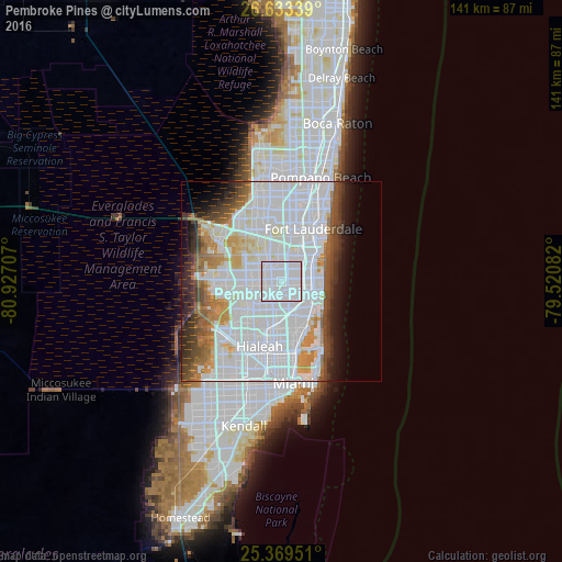
Analysis of Pembroke Pines night lights 2016
Square area 10x10 km:
 84.72%
90-99
15.28%80-89
0%70-79
0%60-69
0%50-59
0%40-49
0%30-39
0%20-29
0%10-19
0%0-9
0%Square area 50x50 km:
35.03%90-99
12.8%80-89
2.86%70-79
3.6%60-69
4.91%50-59
3.51%40-49
4.35%30-39
4.25%20-29
3.55%10-19
4.88%0-9
20.26%Clear (daylight) street map image can be seen on geolist.org.
Map coordinates:
26° 38' 0.2" North, 80° 55' 37.5" West
26° 0' 11.3" North, 80° 13' 26.2" West
25° 22' 10.2" North, 79° 31' 15" West
Some cities around Pembroke Pines sort by population:
• Miramar
1.9 km =1.2 mi,  205°
205°
• West Hollywood
4.4 km =2.7 mi,  64°
64°
• Norland
6.1 km =3.8 mi,  169°
169°
• Ives Estates
6.6 km =4.1 mi,  133°
133°
• West Park
3.2 km =2 mi, 129°
• Andover
4 km =2.5 mi,  163°
163°
• Lake Lucerne
4.6 km =2.9 mi,  202°
202°
• Lake Forest
5 km =3.1 mi,  124°
124°
4168139 (p: 166,611)
Sources (retrieved 2019-11-25):
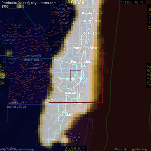
» NASA, Earths city lights 1995
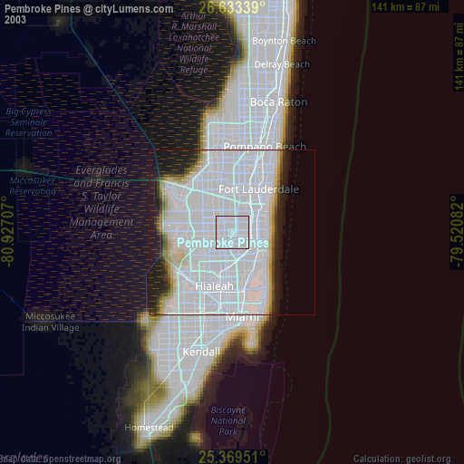
» NASA city lights 2003
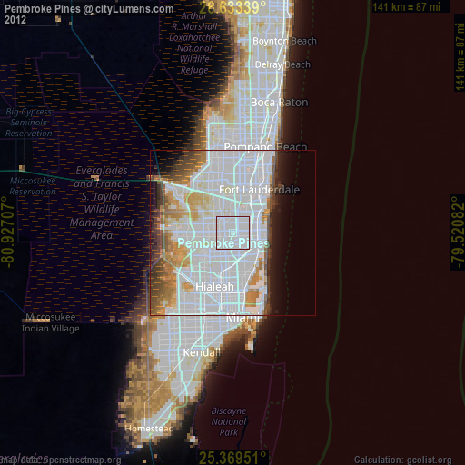
» Earth at Night: Flat Maps 2012, 2016