Miramar night lights from space
Night Light of Miramar (Florida) from space (United States) Src. Average luminocity for 10x10km area is 99.6706% and for 50x50km: 63.8669%.
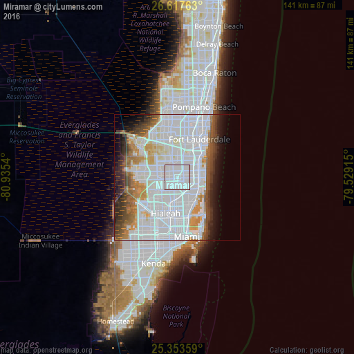
Analysis of Miramar night lights 2016
Square area 10x10 km:
 83.33%
90-99
16.67%80-89
0%70-79
0%60-69
0%50-59
0%40-49
0%30-39
0%20-29
0%10-19
0%0-9
0%Square area 50x50 km:
35.72%90-99
12.69%80-89
2.86%70-79
3.73%60-69
5.02%50-59
3.52%40-49
4.41%30-39
4.35%20-29
3.82%10-19
5.2%0-9
18.67%Clear (daylight) street map image can be seen on geolist.org.
Map coordinates:
26° 37' 3.5" North, 80° 56' 7.4" West
25° 59' 14.3" North, 80° 13' 56.2" West
25° 21' 12.9" North, 79° 31' 44.9" West
Some cities around Miramar sort by population:
• Pembroke Pines
1.9 km =1.2 mi,  25°
25°
• Miami Gardens
5.2 km =3.2 mi,  194°
194°
• Norland
4.7 km =2.9 mi,  154°
154°
• West Park
3.3 km =2.1 mi,  95°
95°
• Scott Lake
5.1 km =3.2 mi,  179°
179°
• Andover
2.9 km =1.8 mi,  137°
137°
• Lake Lucerne
2.6 km =1.6 mi,  200°
200°
• Lake Forest
5 km =3.1 mi, 102°
4164601 (p: 137,132)
Sources (retrieved 2019-11-25):
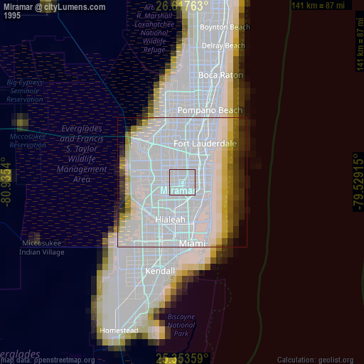
» NASA, Earths city lights 1995
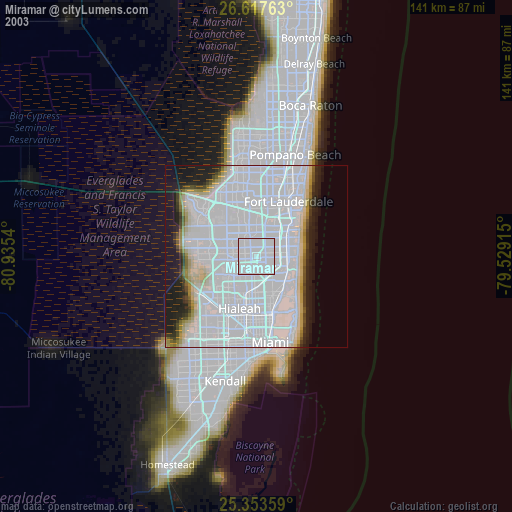
» NASA city lights 2003
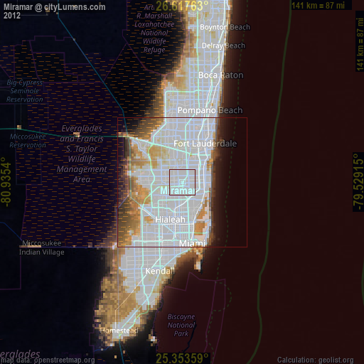
» Earth at Night: Flat Maps 2012, 2016