Paris night lights from space
Night Light of Paris (Maine) from space (United States) Src. Average luminocity for 10x10km area is 5.5136% and for 50x50km: 3.0055%.
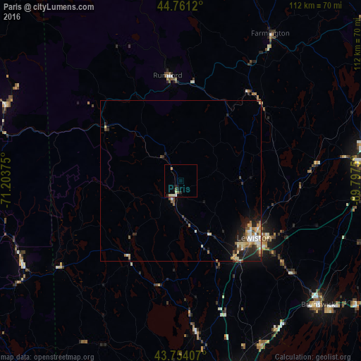
Analysis of Paris night lights 2016
Square area 10x10 km:
 0.3%
0.3%90-99
1.52%80-89
1.21%70-79
0.61%60-69
0%50-59
1.21%40-49
0%30-39
0%20-29
1.82%10-19
1.52%0-9
91.82%Square area 50x50 km:
0.27%90-99
0.57%80-89
0.52%70-79
0.43%60-69
0.38%50-59
0.33%40-49
0.31%30-39
0.28%20-29
1.02%10-19
1.75%0-9
94.14%Clear (daylight) street map image can be seen on geolist.org.
Map coordinates:
44° 45' 40.3" North, 71° 12' 13.5" West
44° 15' 35.2" North, 70° 30' 2.2" West
43° 45' 14.7" North, 69° 47' 51" West
Some cities around Paris sort by population:
• Lewiston
28.9 km =18 mi,  127°
127°
• Auburn
28 km =17.4 mi, 129°
• Lisbon
40.5 km =25.2 mi, 128°
• Topsham
55.9 km =34.7 mi, 131°
• Yarmouth
56.9 km =35.4 mi,  153°
153°
• Turner
19.5 km =12.1 mi,  91°
91°
• New Gloucester
37.3 km =23.2 mi, 152°
• Poland
23.7 km =14.7 mi,  158°
158°
4974617 (p: 5,073)
Sources (retrieved 2019-11-25):
» Earth at Night: Flat Maps 2012, 2016