Palmetto Bay night lights from space
Night Light of Palmetto Bay (Florida) from space (United States) Src. Average luminocity for 10x10km area is 79.697% and for 50x50km: 44.8001%.
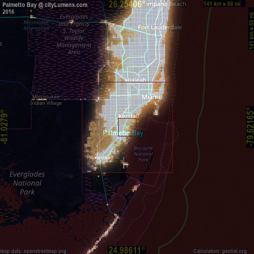
Analysis of Palmetto Bay night lights 2016
Square area 10x10 km:
 21.97%
90-99
29.17%80-89
17.23%70-79
3.79%60-69
7.58%50-59
3.6%40-49
6.25%30-39
2.08%20-29
6.25%10-19
2.08%0-9
0%Square area 50x50 km:
18.7%90-99
8.43%80-89
2.3%70-79
2.43%60-69
8.85%50-59
4.96%40-49
4.17%30-39
3.46%20-29
4.34%10-19
8.31%0-9
34.05%Clear (daylight) street map image can be seen on geolist.org.
Map coordinates:
26° 15' 14.6" North, 81° 1' 40.4" West
25° 37' 18.4" North, 80° 19' 29.2" West
24° 59' 10" North, 79° 37' 17.9" West
Some cities around Palmetto Bay sort by population:
• Cutler Bay
5 km =3.1 mi,  195°
195°
• Cutler Ridge
5.1 km =3.2 mi,  205°
205°
• Pinecrest
5.3 km =3.3 mi,  18°
18°
• Cutler
1.6 km =1 mi,  117°
117°
• Lakes by the Bay
5.5 km =3.4 mi,  180°
180°
• West Perrine
4.2 km =2.6 mi,  245°
245°
• Richmond Heights
4.6 km =2.9 mi,  283°
283°
• East Perrine
2 km =1.2 mi,  224°
224°
4167634 (p: 24,642)
Sources (retrieved 2019-11-25):
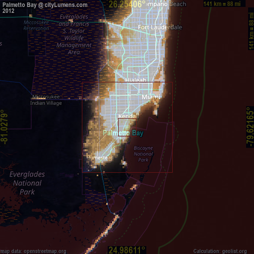
» Earth at Night: Flat Maps 2012, 2016