Ormond Beach night lights from space
Night Light of Ormond Beach (Florida) from space (United States) Src. Average luminocity for 10x10km area is 60.3617% and for 50x50km: 17.1699%.
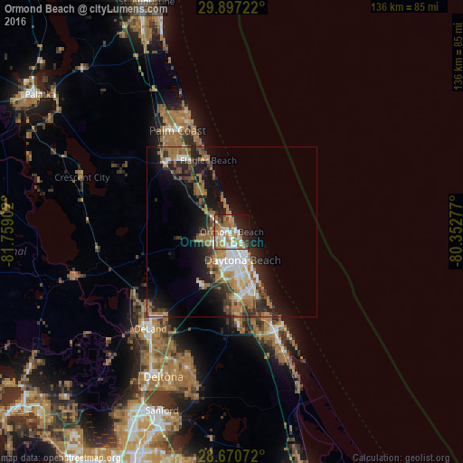
Analysis of Ormond Beach night lights 2016
Square area 10x10 km:
 10.04%
90-99
13.45%80-89
4.92%70-79
9.28%60-69
23.3%50-59
6.25%40-49
4.36%30-39
2.84%20-29
13.83%10-19
9.47%0-9
2.27%Square area 50x50 km:
2.55%90-99
2.73%80-89
0.93%70-79
1.5%60-69
5.8%50-59
2.05%40-49
2.55%30-39
2.65%20-29
4.83%10-19
9.42%0-9
65%Clear (daylight) street map image can be seen on geolist.org.
Map coordinates:
29° 53' 50" North, 81° 45' 32.5" West
29° 17' 8.9" North, 81° 3' 21.2" West
28° 40' 14.6" North, 80° 21' 10" West
Some cities around Ormond Beach sort by population:
• Palm Coast
36.4 km =22.6 mi,  336°
336°
• Daytona Beach
8.9 km =5.5 mi,  158°
158°
• Port Orange
17.4 km =10.8 mi, 160°
• New Smyrna Beach
31.5 km =19.6 mi, 156°
• Edgewater
36.2 km =22.5 mi, 155°
• South Daytona
14.2 km =8.8 mi, 159°
• Holly Hill
5 km =3.1 mi, 159°
• Samsula-Spruce Creek
26.3 km =16.3 mi,  181°
181°
4167178 (p: 40,970)
Sources (retrieved 2019-11-25):
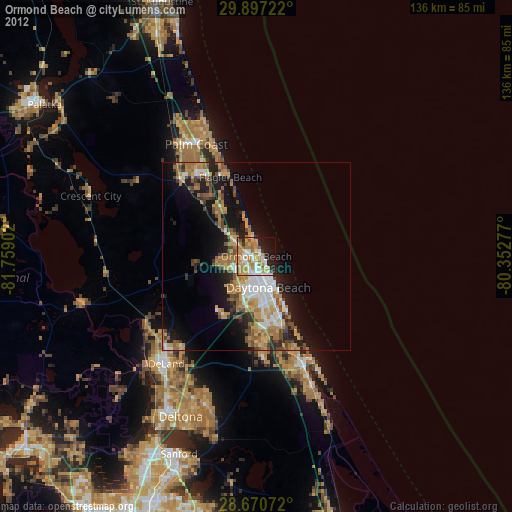
» Earth at Night: Flat Maps 2012, 2016