Old Forge night lights from space
Night Light of Old Forge (Pennsylvania) from space (United States) Src. Average luminocity for 10x10km area is 56.5544% and for 50x50km: 18.6842%.
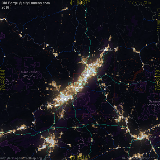
Analysis of Old Forge night lights 2016
Square area 10x10 km:
 10.03%
90-99
12.07%80-89
3.57%70-79
9.52%60-69
12.41%50-59
11.73%40-49
9.18%30-39
3.06%20-29
14.8%10-19
9.69%0-9
3.91%Square area 50x50 km:
2.64%90-99
2.87%80-89
2.04%70-79
2.47%60-69
2.89%50-59
3.05%40-49
2.57%30-39
3.19%20-29
6.3%10-19
10.12%0-9
61.84%Clear (daylight) street map image can be seen on geolist.org.
Map coordinates:
41° 53' 48.1" North, 76° 26' 16.9" West
41° 22' 16.3" North, 75° 44' 5.7" West
40° 50' 29" North, 75° 1' 54.4" West
Some cities around Old Forge sort by population:
• Scranton
7.2 km =4.5 mi,  54°
54°
• Dunmore
10.1 km =6.3 mi,  57°
57°
• Pittston
6.8 km =4.2 mi,  222°
222°
• Taylor
3.5 km =2.2 mi,  41°
41°
• Dickson City
15.4 km =9.6 mi, 43°
• Moosic
2 km =1.2 mi,  188°
188°
• Exeter
9 km =5.6 mi,  231°
231°
• Olyphant
15.4 km =9.6 mi, 45°
5204331 (p: 8,048)
Sources (retrieved 2019-11-25):
» Earth at Night: Flat Maps 2012, 2016