Oconomowoc night lights from space
Night Light of Oconomowoc (Wisconsin) from space (United States) Src. Average luminocity for 10x10km area is 34.0803% and for 50x50km: 15.791%.
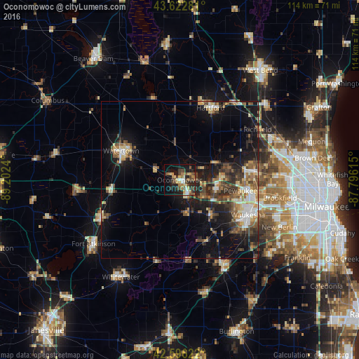
Analysis of Oconomowoc night lights 2016
Square area 10x10 km:
 3.03%
3.03%90-99
3.03%80-89
5.45%70-79
5.15%60-69
6.82%50-59
5%40-49
7.27%30-39
5.45%20-29
10.76%10-19
25.61%0-9
22.42%Square area 50x50 km:
1.57%90-99
1.75%80-89
2.34%70-79
1.77%60-69
2.32%50-59
2.51%40-49
3.25%30-39
2.77%20-29
4.56%10-19
11.49%0-9
65.67%Clear (daylight) street map image can be seen on geolist.org.
Map coordinates:
43° 37' 22.1" North, 89° 12' 8.6" West
43° 6' 42" North, 88° 29' 57.4" West
42° 35' 46.4" North, 87° 47' 46.1" West
Some cities around Oconomowoc sort by population:
• Waukesha
24.4 km =15.2 mi,  117°
117°
• Watertown
20.8 km =12.9 mi,  296°
296°
• Hartford
24.9 km =15.5 mi,  23°
23°
• Sussex
22.6 km =14 mi,  83°
83°
• Hartland
12.8 km =8 mi,  93°
93°
• Pewaukee
19.6 km =12.2 mi,  100°
100°
• Jefferson
27.7 km =17.2 mi,  244°
244°
• Delafield
9.6 km =6 mi,  126°
126°
5265499 (p: 16,360)
Sources (retrieved 2019-11-25):
» Earth at Night: Flat Maps 2012, 2016