Waukesha night lights from space
Night Light of Waukesha (Wisconsin) from space (United States) Src. Average luminocity for 10x10km area is 76.4159% and for 50x50km: 40.8677%.
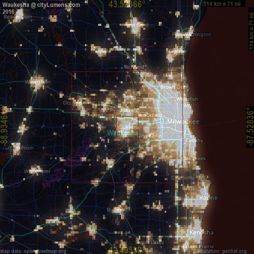
Analysis of Waukesha night lights 2016
Square area 10x10 km:
 21.75%
90-99
19.37%80-89
11.9%70-79
7.94%60-69
10%50-59
12.54%40-49
8.73%30-39
6.19%20-29
1.59%10-19
0%0-9
0%Square area 50x50 km:
11.75%90-99
6.71%80-89
4.17%70-79
4.49%60-69
6.2%50-59
6.13%40-49
5.89%30-39
4.58%20-29
7.14%10-19
10.36%0-9
32.57%Clear (daylight) street map image can be seen on geolist.org.
Map coordinates:
43° 31' 25.2" North, 88° 56' 4.6" West
43° 0' 42" North, 88° 13' 53.3" West
42° 29' 43.4" North, 87° 31' 42.1" West
Some cities around Waukesha sort by population:
• New Berlin
10.7 km =6.6 mi,  111°
111°
• Brookfield
11.5 km =7.1 mi,  61°
61°
• Muskego
14 km =8.7 mi,  147°
147°
• Sussex
13.6 km =8.5 mi,  3°
3°
• Hartland
13.7 km =8.5 mi,  319°
319°
• Pewaukee
8 km =5 mi,  342°
342°
• Delafield
15 km =9.3 mi,  291°
291°
• Elm Grove
12.9 km =8 mi,  74°
74°
5278052 (p: 71,970)
Sources (retrieved 2019-11-25):
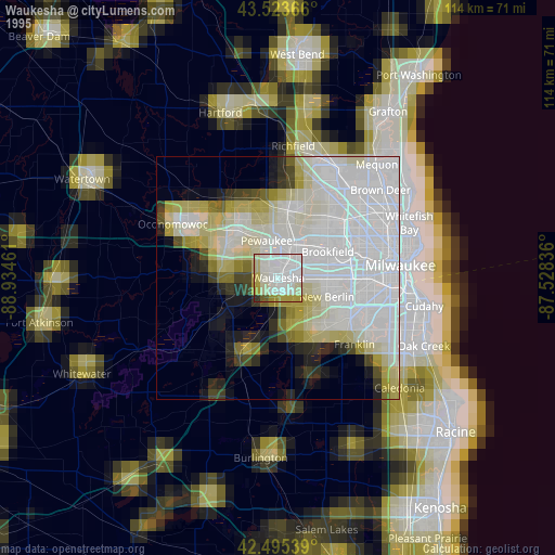
» NASA, Earths city lights 1995
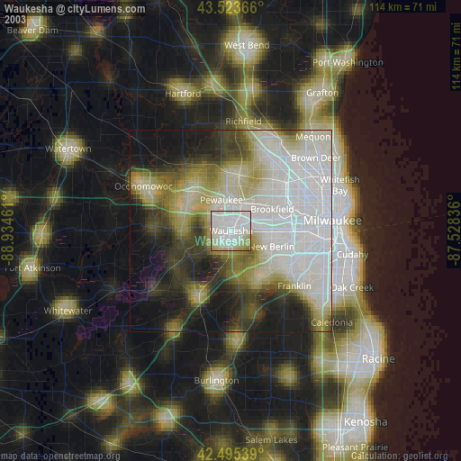
» NASA city lights 2003
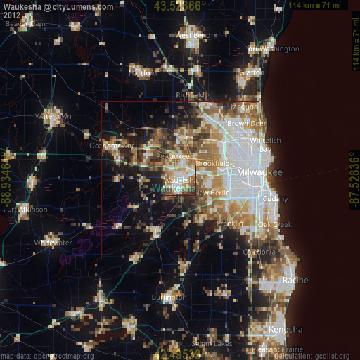
» Earth at Night: Flat Maps 2012, 2016