Hartland night lights from space
Night Light of Hartland (Wisconsin) from space (United States) Src. Average luminocity for 10x10km area is 38.7227% and for 50x50km: 27.9235%.
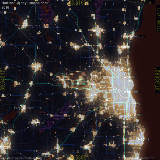
Analysis of Hartland night lights 2016
Square area 10x10 km:
 2.12%
2.12%90-99
1.52%80-89
4.39%70-79
2.42%60-69
5.45%50-59
7.42%40-49
17.12%30-39
16.52%20-29
24.55%10-19
17.88%0-9
0.61%Square area 50x50 km:
4.12%90-99
4.4%80-89
3.42%70-79
3.7%60-69
5.31%50-59
4.89%40-49
5.12%30-39
4.02%20-29
6.43%10-19
11.41%0-9
47.18%Clear (daylight) street map image can be seen on geolist.org.
Map coordinates:
43° 36' 58.4" North, 89° 2' 42.6" West
43° 6' 18" North, 88° 20' 31.3" West
42° 35' 22.2" North, 87° 38' 20.1" West
Some cities around Hartland sort by population:
• Waukesha
13.7 km =8.5 mi,  139°
139°
• Brookfield
19.8 km =12.3 mi,  104°
104°
• Menomonee Falls
20 km =12.4 mi,  65°
65°
• Oconomowoc
12.8 km =8 mi,  273°
273°
• Richfield
20.6 km =12.8 mi,  35°
35°
• Sussex
10.3 km =6.4 mi, 71°
• Pewaukee
7.1 km =4.4 mi,  112°
112°
• Delafield
7 km =4.3 mi,  225°
225°
5255640 (p: 9,219)
Sources (retrieved 2019-11-25):
» Earth at Night: Flat Maps 2012, 2016