Norton Shores night lights from space
Night Light of Norton Shores (Michigan) from space (United States) Src. Average luminocity for 10x10km area is 51.597% and for 50x50km: 8.8038%.
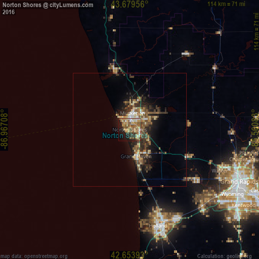
Analysis of Norton Shores night lights 2016
Square area 10x10 km:
 4.09%
4.09%90-99
10%80-89
10.61%70-79
8.64%60-69
9.24%50-59
14.85%40-49
5.15%30-39
4.55%20-29
8.48%10-19
15.91%0-9
8.48%Square area 50x50 km:
0.56%90-99
1.12%80-89
1.4%70-79
0.93%60-69
1.35%50-59
1.7%40-49
1.72%30-39
1.91%20-29
3.37%10-19
4.78%0-9
81.17%Clear (daylight) street map image can be seen on geolist.org.
Map coordinates:
43° 40' 46.4" North, 86° 58' 1.5" West
43° 10' 8" North, 86° 15' 50.2" West
42° 39' 14.1" North, 85° 33' 39" West
Some cities around Norton Shores sort by population:
• Muskegon
7.4 km =4.6 mi,  9°
9°
• Holland
44.2 km =27.5 mi,  163°
163°
• Walker
44.4 km =27.6 mi,  114°
114°
• Allendale
33.4 km =20.8 mi,  130°
130°
• Grand Haven
12.1 km =7.5 mi,  166°
166°
• Muskegon Heights
4.1 km =2.5 mi,  29°
29°
• Hudsonville
46.4 km =28.8 mi,  135°
135°
• Zeeland
44.4 km =27.6 mi,  153°
153°
5004005 (p: 24,208)
Sources (retrieved 2019-11-25):
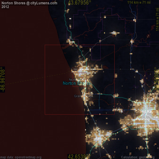
» Earth at Night: Flat Maps 2012, 2016