Muskegon Heights night lights from space
Night Light of Muskegon Heights (Michigan) from space (United States) Src. Average luminocity for 10x10km area is 69.7652% and for 50x50km: 9.3984%.
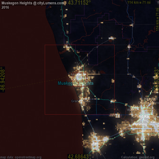
Analysis of Muskegon Heights night lights 2016
Square area 10x10 km:
 9.85%
9.85%90-99
16.52%80-89
14.55%70-79
9.7%60-69
11.67%50-59
18.94%40-49
9.39%30-39
2.58%20-29
5.91%10-19
0.91%0-9
0%Square area 50x50 km:
0.58%90-99
1.18%80-89
1.62%70-79
1.02%60-69
1.39%50-59
1.81%40-49
1.83%30-39
1.98%20-29
3.47%10-19
4.89%0-9
80.23%Clear (daylight) street map image can be seen on geolist.org.
Map coordinates:
43° 42' 41.5" North, 86° 56' 31.5" West
43° 12' 4.1" North, 86° 14' 20.2" West
42° 41' 11.1" North, 85° 32' 9" West
Some cities around Muskegon Heights sort by population:
• Holland
47.2 km =29.3 mi,  167°
167°
• Walker
44.2 km =27.5 mi,  120°
120°
• Norton Shores
4.1 km =2.5 mi,  209°
209°
• Allendale
34.4 km =21.4 mi,  137°
137°
• Jenison
48.9 km =30.4 mi,  131°
131°
• Grand Haven
15.4 km =9.6 mi,  176°
176°
• Hudsonville
47.7 km =29.6 mi, 140°
• Zeeland
46.8 km =29.1 mi,  157°
157°
5003140 (p: 10,796)
Sources (retrieved 2019-11-25):
» Earth at Night: Flat Maps 2012, 2016