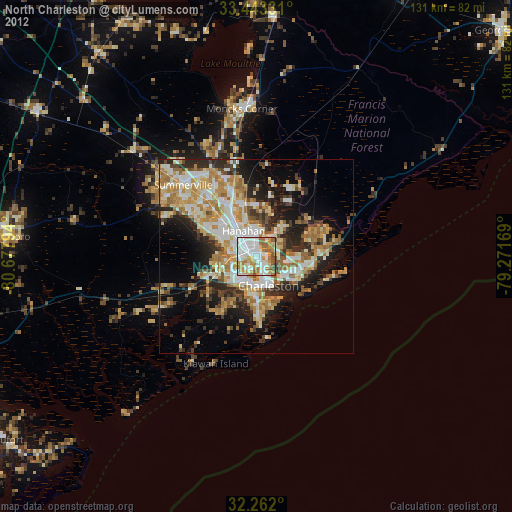
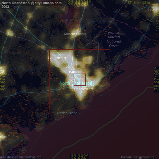
North Charleston night lights from space
Night Light of North Charleston (South Carolina) from space (United States) Src. Average luminocity for 10x10km area is 87.6119% and for 50x50km: 37.8683%.


Analysis of North Charleston night lights 2016
Square area 10x10 km:
 28.5%
28.5%90-99
25.35%80-89
12.41%70-79
21.33%60-69
12.41%50-59
0%40-49
0%30-39
0%20-29
0%10-19
0%0-9
0%Square area 50x50 km:
5.95%90-99
6.14%80-89
6.18%70-79
8.72%60-69
7.56%50-59
2.85%40-49
3.73%30-39
6.01%20-29
7.26%10-19
10.81%0-9
34.79%Clear (daylight) street map image can be seen on geolist.org.
Map coordinates:
33° 26' 35.9" North, 80° 40' 40.6" West
32° 51' 16.6" North, 79° 58' 29.3" West
32° 15' 43.2" North, 79° 16' 18.1" West
Some cities around North Charleston sort by population:
• Charleston
9.6 km =6 mi,  154°
154°
• Mount Pleasant
12.5 km =7.8 mi,  122°
122°
• Goose Creek
15.1 km =9.4 mi,  339°
339°
• Hanahan
8.4 km =5.2 mi,  328°
328°
• Ladson
19.3 km =12 mi,  319°
319°
• Sangaree
24.7 km =15.3 mi, 324°
• James Island
14.6 km =9.1 mi,  175°
175°
• Centerville
24.1 km =15 mi,  310°
310°
4589387 (p: 108,304)
Sources (retrieved 2019-11-25):
» NASA, Earths city lights 1995
» NASA city lights 2003
» Earth at Night: Flat Maps 2012, 2016