Charleston night lights from space
Night Light of Charleston (South Carolina) from space (United States) Src. Average luminocity for 10x10km area is 68.2465% and for 50x50km: 30.066%.

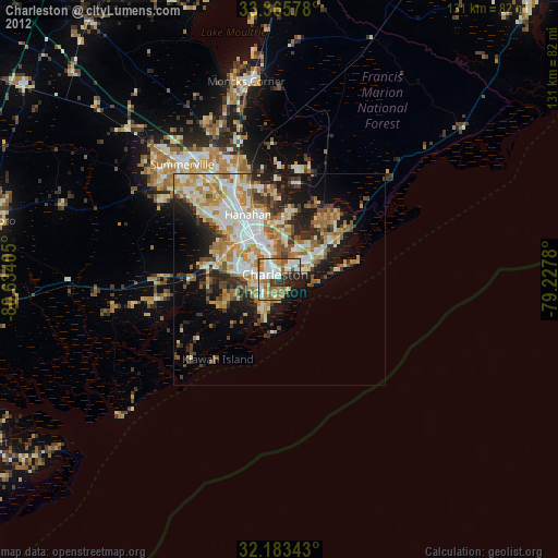
Analysis of Charleston night lights 2016
Square area 10x10 km:
 16.08%
90-99
14.51%80-89
6.64%70-79
12.06%60-69
22.55%50-59
4.37%40-49
4.37%30-39
6.99%20-29
6.82%10-19
5.42%0-9
0.17%Square area 50x50 km:
4.96%90-99
4.9%80-89
4.84%70-79
6.42%60-69
5.92%50-59
2.24%40-49
3.33%30-39
4.93%20-29
6.02%10-19
8.12%0-9
48.31%Clear (daylight) street map image can be seen on geolist.org.
Map coordinates:
33° 21' 56.8" North, 80° 38' 2.6" West
32° 46' 35.7" North, 79° 55' 51.3" West
32° 11' 0.3" North, 79° 13' 40.1" West
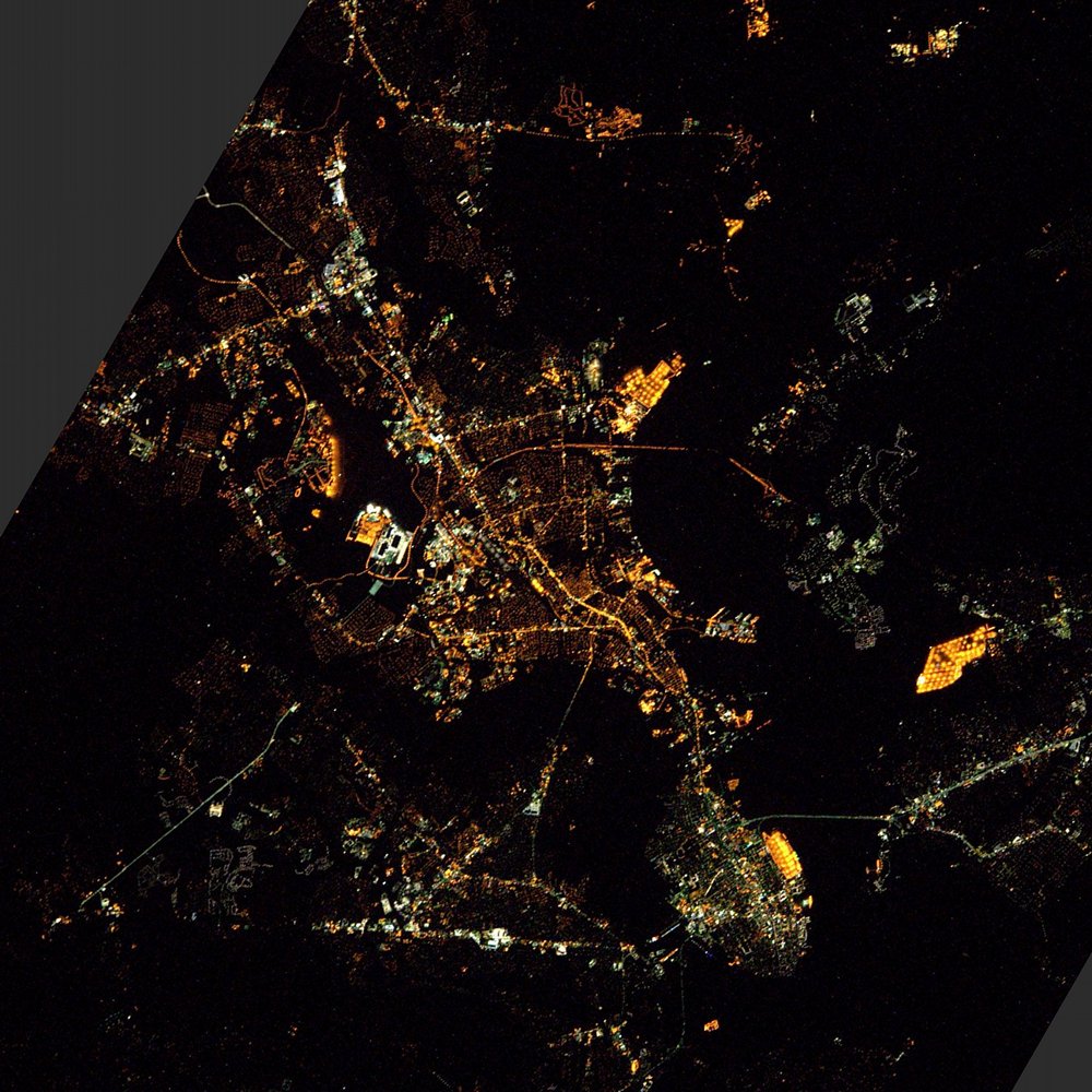
Fantastic image of Charleston from space taken by astronauts [src2], but I don't have information about it's orientation, scale or angle. If necessary, it was rotated manually, so North points approximately to upper direction. Click to zoom in:
Some cities around Charleston sort by population:
• North Charleston
9.6 km =6 mi,  334°
334°
• Mount Pleasant
6.7 km =4.2 mi,  73°
73°
• Goose Creek
24.6 km =15.3 mi,  337°
337°
• Hanahan
17.9 km =11.1 mi, 331°
• Ladson
28.6 km =17.8 mi,  324°
324°
• Sangaree
34.2 km =21.3 mi, 327°
• James Island
6.6 km =4.1 mi,  206°
206°
• Centerville
33.1 km =20.6 mi, 317°
4574324 (p: 132,609)
Sources (retrieved 2019-11-25):
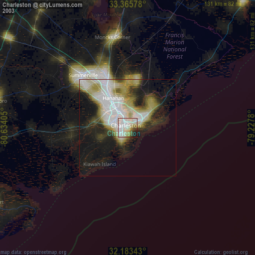
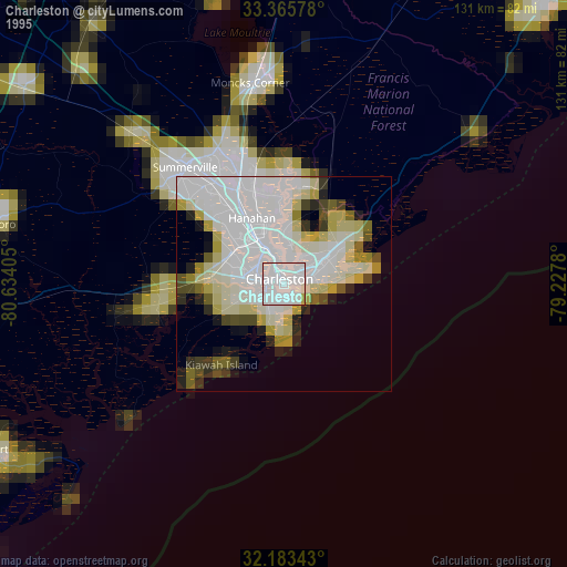
» NASA, Earths city lights 1995
» NASA city lights 2003
» Earth at Night: Flat Maps 2012, 2016
Src.2: Tim Kopra, Twitter/@astro_tim, 2016-04-21