James Island night lights from space
Night Light of James Island (South Carolina) from space (United States) Src. Average luminocity for 10x10km area is 47.7098% and for 50x50km: 25.1875%.
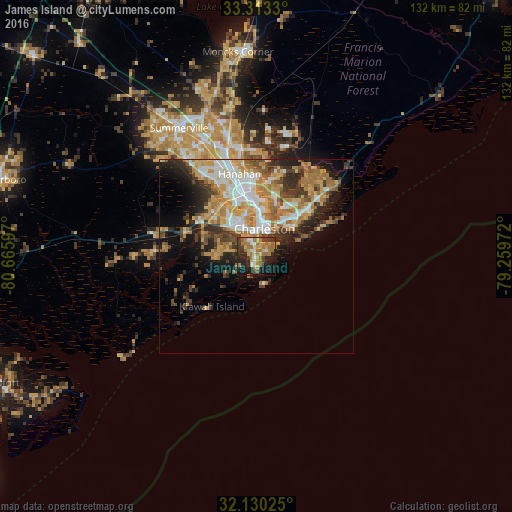
Analysis of James Island night lights 2016
Square area 10x10 km:
 2.62%
2.62%90-99
5.42%80-89
7.69%70-79
9.44%60-69
20.28%50-59
2.1%40-49
5.42%30-39
9.44%20-29
12.94%10-19
22.03%0-9
2.62%Square area 50x50 km:
4.07%90-99
3.97%80-89
3.81%70-79
4.71%60-69
5.52%50-59
2.04%40-49
2.97%30-39
4.29%20-29
5.23%10-19
7.93%0-9
55.46%Clear (daylight) street map image can be seen on geolist.org.
Map coordinates:
33° 18' 47.9" North, 80° 39' 57.5" West
32° 43' 25.5" North, 79° 57' 46.2" West
32° 7' 48.9" North, 79° 15' 35" West
Some cities around James Island sort by population:
• Charleston
6.6 km =4.1 mi,  26°
26°
• North Charleston
14.6 km =9.1 mi,  355°
355°
• Mount Pleasant
12.2 km =7.6 mi,  50°
50°
• Goose Creek
29.3 km =18.2 mi,  347°
347°
• Hanahan
22.4 km =13.9 mi, 345°
• Ladson
32.2 km =20 mi,  334°
334°
• Sangaree
37.9 km =23.5 mi,  336°
336°
• Centerville
35.9 km =22.3 mi, 327°
12022259 (p: 6,000)
Sources (retrieved 2019-11-25):
» Earth at Night: Flat Maps 2012, 2016