Mount Pleasant night lights from space
Night Light of Mount Pleasant (South Carolina) from space (United States) Src. Average luminocity for 10x10km area is 55.0647% and for 50x50km: 28.6631%.
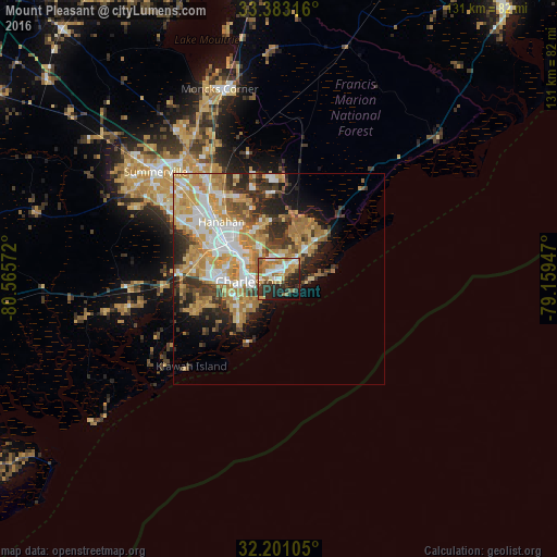

Analysis of Mount Pleasant night lights 2016
Square area 10x10 km:
 9.44%
9.44%90-99
9.97%80-89
6.99%70-79
8.04%60-69
15.73%50-59
5.24%40-49
5.42%30-39
7.17%20-29
19.76%10-19
8.74%0-9
3.5%Square area 50x50 km:
4.91%90-99
4.77%80-89
4.78%70-79
6.06%60-69
5.87%50-59
2.29%40-49
2.97%30-39
4.43%20-29
5.55%10-19
6.18%0-9
52.18%Clear (daylight) street map image can be seen on geolist.org.
Map coordinates:
33° 22' 59.4" North, 80° 33' 56.6" West
32° 47' 38.7" North, 79° 51' 45.3" West
32° 12' 3.8" North, 79° 9' 34.1" West
Some cities around Mount Pleasant sort by population:
• Charleston
6.7 km =4.2 mi,  253°
253°
• North Charleston
12.5 km =7.8 mi,  302°
302°
• Goose Creek
26.2 km =16.3 mi,  322°
322°
• Hanahan
20.3 km =12.6 mi,  312°
312°
• Ladson
31.4 km =19.5 mi, 312°
• Sangaree
36.5 km =22.7 mi, 317°
• James Island
12.2 km =7.6 mi,  230°
230°
• Centerville
36.4 km =22.6 mi, 307°
4588165 (p: 81,317)
Sources (retrieved 2019-11-25):
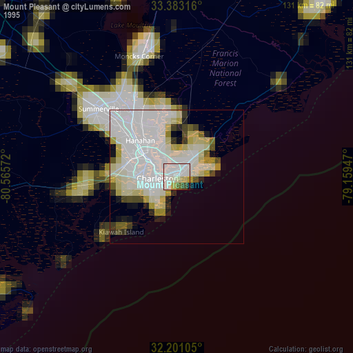
» NASA, Earths city lights 1995
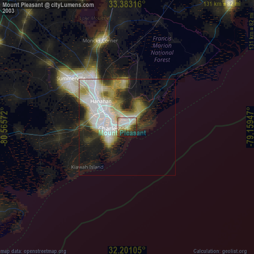
» NASA city lights 2003
» Earth at Night: Flat Maps 2012, 2016