Mount Rainier night lights from space
Night Light of Mount Rainier (Maryland) from space (United States) Src. Average luminocity for 10x10km area is 99.3384% and for 50x50km: 78.596%.
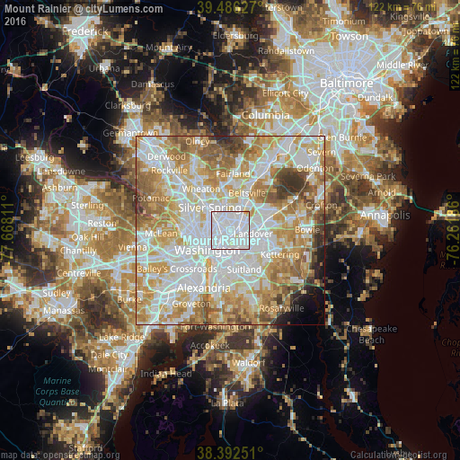
Analysis of Mount Rainier night lights 2016
Square area 10x10 km:
 82.31%
90-99
14.97%80-89
2.38%70-79
0.34%60-69
0%50-59
0%40-49
0%30-39
0%20-29
0%10-19
0%0-9
0%Square area 50x50 km:
25.22%90-99
19.81%80-89
11.98%70-79
13.52%60-69
10.21%50-59
7.47%40-49
3.53%30-39
3.04%20-29
1.52%10-19
1.61%0-9
2.09%Clear (daylight) street map image can be seen on geolist.org.
Map coordinates:
39° 29' 10.6" North, 77° 40' 5.2" West
38° 56' 29.4" North, 76° 57' 53.9" West
38° 23' 33" North, 76° 15' 42.7" West
Some cities around Mount Rainier sort by population:
• Chillum
3.3 km =2.1 mi,  317°
317°
• College Park
5 km =3.1 mi,  29°
29°
• Langley Park
5.4 km =3.4 mi,  344°
344°
• Hyattsville
2.3 km =1.4 mi,  46°
46°
• East Riverdale
4.4 km =2.7 mi,  58°
58°
• Bladensburg
2.7 km =1.7 mi,  95°
95°
• Riverdale Park
3.8 km =2.4 mi, 49°
• Cheverly
4.5 km =2.8 mi,  109°
109°
4363124 (p: 8,475)
Sources (retrieved 2019-11-25):
» Earth at Night: Flat Maps 2012, 2016