Mena night lights from space
Night Light of Mena (Arkansas) from space (United States) Src. Average luminocity for 10x10km area is 17.8287% and for 50x50km: 0.9458%.
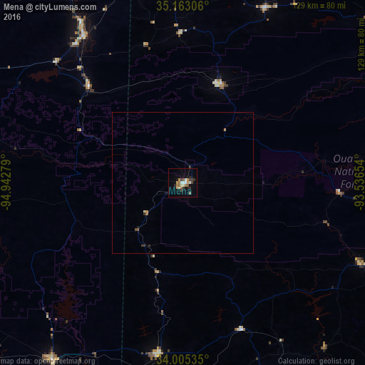
Analysis of Mena night lights 2016
Square area 10x10 km:
 1.57%
1.57%90-99
2.45%80-89
2.27%70-79
2.97%60-69
1.92%50-59
3.5%40-49
0.87%30-39
4.55%20-29
1.57%10-19
5.59%0-9
72.73%Square area 50x50 km:
0.06%90-99
0.11%80-89
0.11%70-79
0.18%60-69
0.1%50-59
0.16%40-49
0.08%30-39
0.32%20-29
0.08%10-19
0.27%0-9
98.54%Clear (daylight) street map image can be seen on geolist.org.
Map coordinates:
35° 9' 47" North, 94° 56' 34" West
34° 35' 10.4" North, 94° 14' 22.8" West
34° 0' 19.3" North, 93° 32' 11.5" West
Some cities around Mena sort by population:
• Fort Smith
90.1 km =56 mi,  350°
350°
• Hot Springs National Park
107.8 km =67 mi,  93°
93°
• Van Buren
95.1 km =59.1 mi, 354°
• Greenwood
70 km =43.5 mi,  358°
358°
• Poteau
62.7 km =39 mi,  326°
326°
• Idabel
93.8 km =58.3 mi,  215°
215°
• De Queen
61.7 km =38.3 mi,  188°
188°
• Alma
99.2 km =61.6 mi,  0°
0°
4121297 (p: 5,653)
Sources (retrieved 2019-11-25):
» Earth at Night: Flat Maps 2012, 2016