Fort Smith night lights from space
Night Light of Fort Smith (Arkansas) from space (United States) Src. Average luminocity for 10x10km area is 74.4396% and for 50x50km: 14.844%.
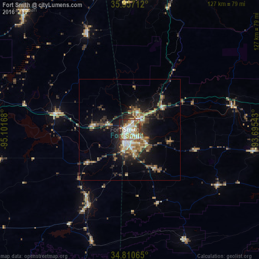
Analysis of Fort Smith night lights 2016
Square area 10x10 km:
 19.78%
90-99
21.79%80-89
11.17%70-79
11.9%60-69
9.71%50-59
5.68%40-49
2.01%30-39
7.88%20-29
8.24%10-19
1.83%0-9
0%Square area 50x50 km:
1.68%90-99
2.16%80-89
2.05%70-79
1.72%60-69
1.94%50-59
2.64%40-49
1.73%30-39
3.48%20-29
3.88%10-19
8.86%0-9
69.87%Clear (daylight) street map image can be seen on geolist.org.
Map coordinates:
35° 57' 25.6" North, 95° 6' 6" West
35° 23' 9.3" North, 94° 23' 54.8" West
34° 48' 38.3" North, 93° 41' 43.5" West
Some cities around Fort Smith sort by population:
• Fayetteville
78.3 km =48.7 mi,  16°
16°
• Van Buren
7.3 km =4.5 mi,  38°
38°
• Greenwood
22.9 km =14.2 mi,  145°
145°
• Poteau
42.2 km =26.2 mi,  208°
208°
• Sallisaw
36.2 km =22.5 mi,  283°
283°
• Farmington
74.2 km =46.1 mi,  10°
10°
• Alma
19 km =11.8 mi,  57°
57°
• Prairie Grove
66 km =41 mi, 6°
4111410 (p: 88,194)
Sources (retrieved 2019-11-25):
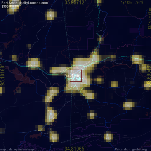
» NASA, Earths city lights 1995
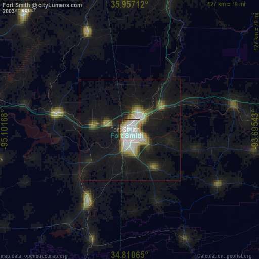
» NASA city lights 2003
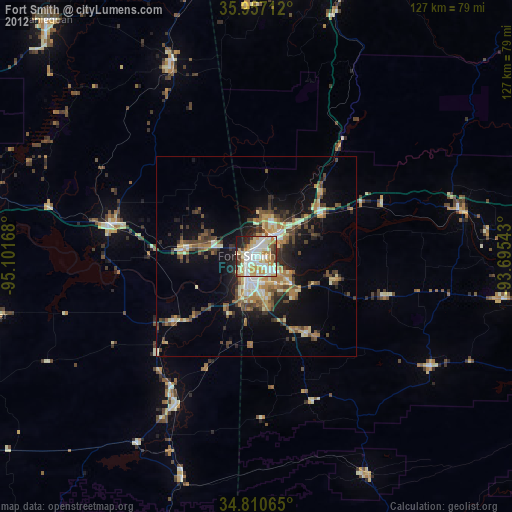
» Earth at Night: Flat Maps 2012, 2016