Mission night lights from space
Night Light of Mission (Texas) from space (United States) Src. Average luminocity for 10x10km area is 87.2024% and for 50x50km: 45.5015%.
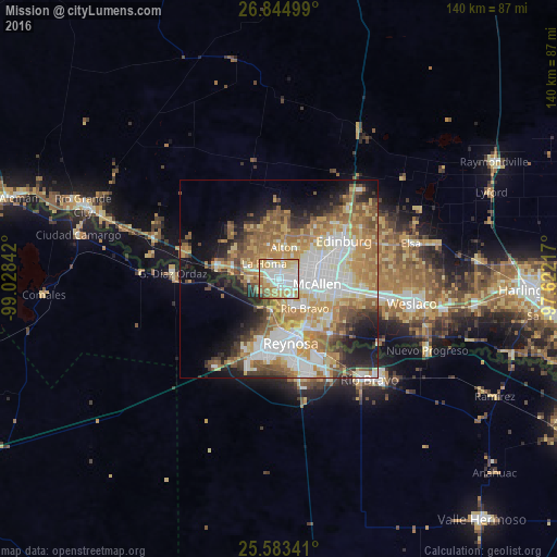
Analysis of Mission night lights 2016
Square area 10x10 km:
 27.38%
90-99
26.39%80-89
16.87%70-79
16.87%60-69
7.14%50-59
4.17%40-49
0%30-39
0.79%20-29
0.4%10-19
0%0-9
0%Square area 50x50 km:
10.15%90-99
7.97%80-89
6.9%70-79
8.04%60-69
8.43%50-59
7.26%40-49
4.07%30-39
3.77%20-29
5.72%10-19
9.33%0-9
28.36%Clear (daylight) street map image can be seen on geolist.org.
Map coordinates:
26° 50' 42" North, 99° 1' 42.3" West
26° 12' 57.3" North, 98° 19' 31" West
25° 35' 0.3" North, 97° 37' 19.8" West
Some cities around Mission sort by population:
• McAllen
9.6 km =6 mi,  98°
98°
• Alton
8 km =5 mi,  8°
8°
• La Homa
5.4 km =3.4 mi,  314°
314°
• Palmview
4.9 km =3 mi,  293°
293°
• Palmview South
5.3 km =3.3 mi,  269°
269°
• Alton North (historical)
9.1 km =5.7 mi, 13°
• Perezville
7.6 km =4.7 mi,  277°
277°
• Doffing
8.9 km =5.5 mi,  317°
317°
4711725 (p: 83,298)
Sources (retrieved 2019-11-25):
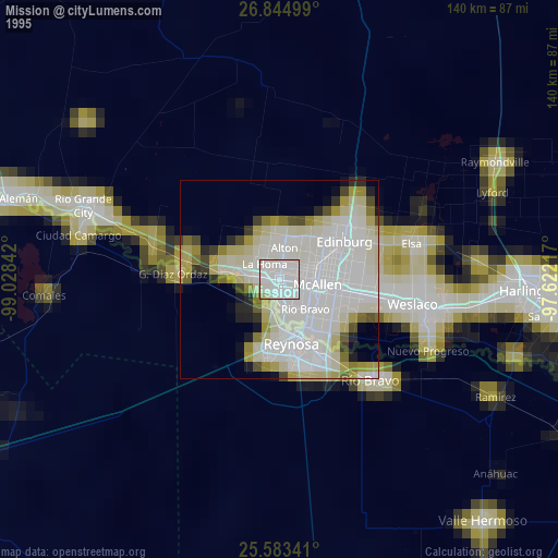
» NASA, Earths city lights 1995
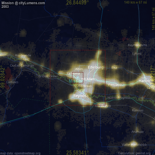
» NASA city lights 2003
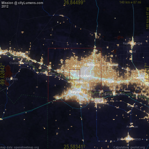
» Earth at Night: Flat Maps 2012, 2016