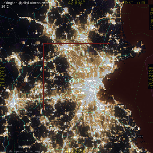
Lexington night lights from space
Night Light of Lexington (Massachusetts) from space (United States) Src. Average luminocity for 10x10km area is 70.9984% and for 50x50km: 56.3233%.
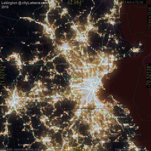
Analysis of Lexington night lights 2016
Square area 10x10 km:
 9.84%
9.84%90-99
14.29%80-89
7.94%70-79
13.49%60-69
26.03%50-59
20.16%40-49
2.54%30-39
4.13%20-29
1.59%10-19
0%0-9
0%Square area 50x50 km:
13.21%90-99
11.39%80-89
6.56%70-79
7.46%60-69
9.3%50-59
9.66%40-49
6.66%30-39
6.29%20-29
9.24%10-19
14.63%0-9
5.6%Clear (daylight) street map image can be seen on geolist.org.
Map coordinates:
42° 57' 50.4" North, 71° 55' 39.5" West
42° 26' 50.4" North, 71° 13' 28.2" West
41° 55' 34.8" North, 70° 31' 17" West
Some cities around Lexington sort by population:
• Waltham
7.9 km =4.9 mi,  186°
186°
• Arlington
6.6 km =4.1 mi,  122°
122°
• Woburn
6.9 km =4.3 mi,  59°
59°
• Belmont
6.8 km =4.2 mi,  146°
146°
• Burlington
6.8 km =4.2 mi,  20°
20°
• Winchester
7.2 km =4.5 mi,  85°
85°
• Bedford
6.4 km =4 mi,  318°
318°
• Lincoln
6.9 km =4.3 mi,  249°
249°
4941935 (p: 31,394)
Sources (retrieved 2019-11-25):
» Earth at Night: Flat Maps 2012, 2016