Kewanee night lights from space
Night Light of Kewanee (Illinois) from space (United States) Src. Average luminocity for 10x10km area is 21.2094% and for 50x50km: 2.6495%.
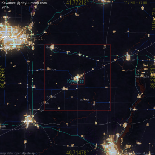
Analysis of Kewanee night lights 2016
Square area 10x10 km:
 0.97%
0.97%90-99
2.76%80-89
5.36%70-79
1.62%60-69
3.9%50-59
3.25%40-49
2.27%30-39
3.08%20-29
0.97%10-19
15.75%0-9
60.06%Square area 50x50 km:
0.08%90-99
0.26%80-89
0.62%70-79
0.33%60-69
0.48%50-59
0.48%40-49
0.33%30-39
0.51%20-29
0.42%10-19
0.76%0-9
95.74%Clear (daylight) street map image can be seen on geolist.org.
Map coordinates:
41° 46' 19.6" North, 90° 37' 40.7" West
41° 14' 44.1" North, 89° 55' 29.4" West
40° 42' 53.2" North, 89° 13' 18.2" West
Some cities around Kewanee sort by population:
• Moline
57.2 km =35.5 mi,  300°
300°
• Galesburg
50 km =31.1 mi,  228°
228°
• East Moline
51.8 km =32.2 mi, 303°
• Princeton
40.8 km =25.4 mi,  70°
70°
• Silvis
50.5 km =31.4 mi,  305°
305°
• Geneseo
29.6 km =18.4 mi,  319°
319°
• Chillicothe
51.4 km =31.9 mi,  134°
134°
• Colona
44.5 km =27.7 mi, 306°
4898433 (p: 12,533)
Sources (retrieved 2019-11-25):
» Earth at Night: Flat Maps 2012, 2016