Vancouver night lights from space
Night Light of Vancouver (Washington) from space (United States) Src. Average luminocity for 10x10km area is 81.2576% and for 50x50km: 41.7543%.
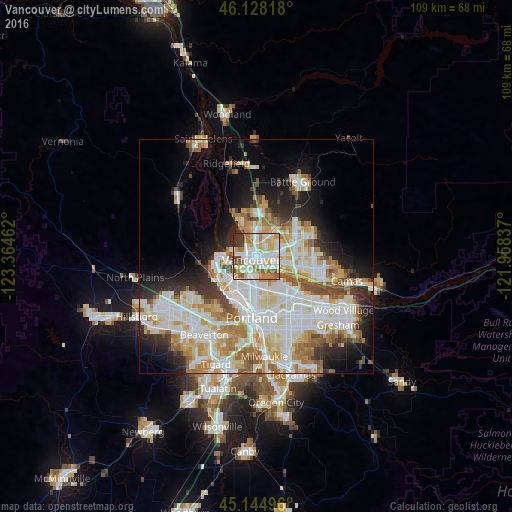
Analysis of Vancouver night lights 2016
Square area 10x10 km:
 22.58%
90-99
26.52%80-89
13.03%70-79
11.36%60-69
9.09%50-59
7.73%40-49
3.33%30-39
4.85%20-29
1.52%10-19
0%0-9
0%Square area 50x50 km:
11.1%90-99
11.57%80-89
5.3%70-79
5.44%60-69
4.94%50-59
3.75%40-49
3.01%30-39
2.88%20-29
5.78%10-19
8.54%0-9
37.68%Clear (daylight) street map image can be seen on geolist.org.
Map coordinates:
46° 7' 41.4" North, 123° 21' 52.6" West
45° 38' 19.4" North, 122° 39' 41.4" West
45° 8' 41.9" North, 121° 57' 30.1" West
Some cities around Vancouver sort by population:
• Salmon Creek
8.1 km =5 mi,  6°
6°
• Hazel Dell
3.6 km =2.2 mi,  358°
358°
• Walnut Grove
5.8 km =3.6 mi,  56°
56°
• Minnehaha
2.5 km =1.6 mi,  23°
23°
• Kenton
6.5 km =4 mi,  193°
193°
• North Portland
4.5 km =2.8 mi,  225°
225°
• Lake Shore
6.2 km =3.9 mi,  338°
338°
• Barberton
7.8 km =4.8 mi,  38°
38°
5814616 (p: 172,860)
Sources (retrieved 2019-11-25):
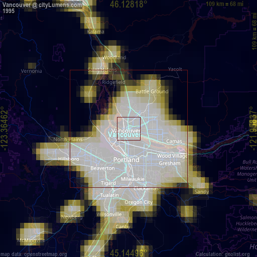
» NASA, Earths city lights 1995
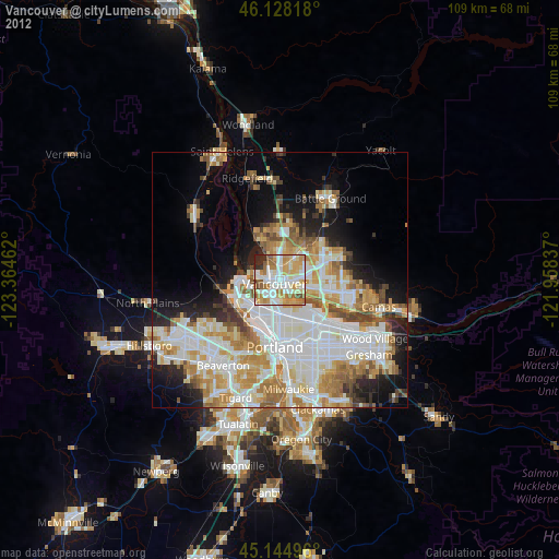
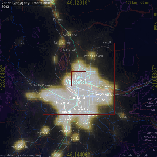
» NASA city lights 2003
» Earth at Night: Flat Maps 2012, 2016