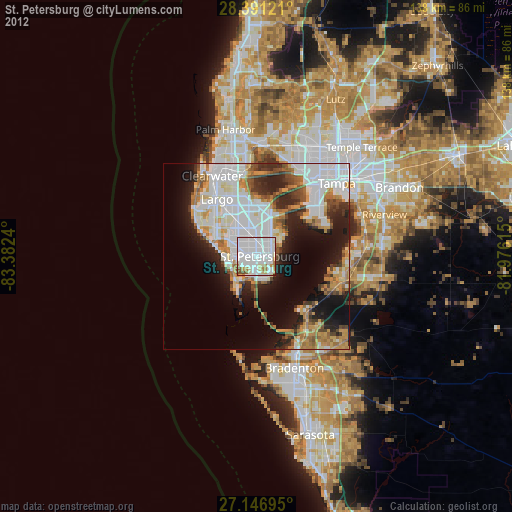
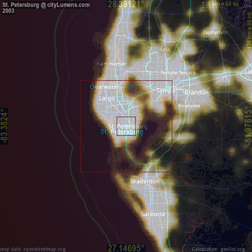
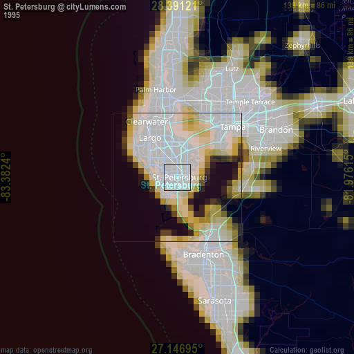
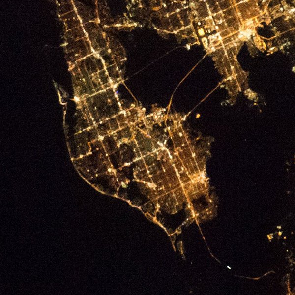
St. Petersburg night lights from space
Night Light of St. Petersburg (Florida) from space (United States) Src. Average luminocity for 10x10km area is 95.8968% and for 50x50km: 39.8814%.
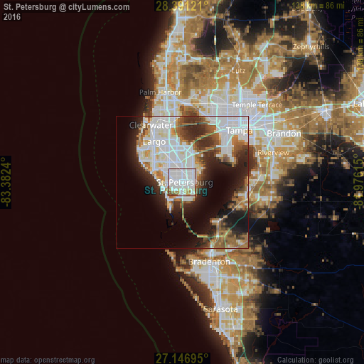
Analysis of St. Petersburg night lights 2016
Square area 10x10 km:
 68.25%
90-99
18.25%80-89
4.56%70-79
3.37%60-69
3.17%50-59
1.98%40-49
0.4%30-39
0%20-29
0%10-19
0%0-9
0%Square area 50x50 km:
14.77%90-99
8.39%80-89
2.57%70-79
2.17%60-69
6.06%50-59
3.76%40-49
3.63%30-39
3.98%20-29
8.2%10-19
11.32%0-9
35.14%Clear (daylight) street map image can be seen on geolist.org.
Map coordinates:
28° 23' 28.4" North, 83° 22' 56.6" West
27° 46' 15.1" North, 82° 40' 45.4" West
27° 8' 49" North, 81° 58' 34.1" West
Fantastic image of St. Petersburg from space taken by astronauts [src2], but I don't have information about it's orientation, scale or angle. If necessary, it was rotated manually, so North points approximately to upper direction. Click to zoom in:
Some cities around St. Petersburg sort by population:
• Pinellas Park
8.2 km =5.1 mi,  346°
346°
• West and East Lealman
5.5 km =3.4 mi, 349°
• Lealman
5.6 km =3.5 mi,  0°
0°
• Gulfport
3.5 km =2.2 mi,  223°
223°
• Saint Pete Beach
7.9 km =4.9 mi,  230°
230°
• Treasure Island
8.8 km =5.5 mi,  268°
268°
• South Pasadena
6 km =3.7 mi,  252°
252°
• Kenneth City
6.4 km =4 mi,  321°
321°
4171563 (p: 257,083)
Sources (retrieved 2019-11-25):
» NASA, Earths city lights 1995
» NASA city lights 2003
» Earth at Night: Flat Maps 2012, 2016
Src.2: Shane Kimbrough Twitter@astro_kimbroughĀĀ2017-01-12