Johnson City night lights from space
Night Light of Johnson City (New York) from space (United States) Src. Average luminocity for 10x10km area is 61.5197% and for 50x50km: 7.243%.
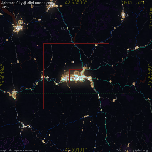
Analysis of Johnson City night lights 2016
Square area 10x10 km:
 14.39%
90-99
15.3%80-89
4.7%70-79
5.15%60-69
11.36%50-59
11.21%40-49
8.79%30-39
4.39%20-29
21.21%10-19
3.48%0-9
0%Square area 50x50 km:
1.01%90-99
1.18%80-89
0.67%70-79
0.63%60-69
1.07%50-59
1.06%40-49
1.17%30-39
1.18%20-29
2.57%10-19
4.89%0-9
84.57%Clear (daylight) street map image can be seen on geolist.org.
Map coordinates:
42° 38' 6.2" North, 76° 39' 43" West
42° 6' 56.3" North, 75° 57' 31.7" West
41° 35' 30.9" North, 75° 15' 20.5" West
Some cities around Johnson City sort by population:
• Binghamton
3.9 km =2.4 mi,  119°
119°
• Ithaca
57.1 km =35.5 mi,  309°
309°
• Cortland
57 km =35.4 mi,  341°
341°
• Endicott
7.7 km =4.8 mi,  255°
255°
• Endwell
5.1 km =3.2 mi,  266°
266°
• South Hill
56.2 km =34.9 mi, 308°
• Lakeview
36 km =22.4 mi,  12°
12°
• Sayre
48.4 km =30.1 mi,  251°
251°
5122794 (p: 14,773)
Sources (retrieved 2019-11-25):
» Earth at Night: Flat Maps 2012, 2016