Jesup night lights from space
Night Light of Jesup (Georgia) from space (United States) Src. Average luminocity for 10x10km area is 38.3132% and for 50x50km: 4.2618%.
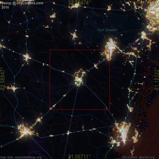
Analysis of Jesup night lights 2016
Square area 10x10 km:
 4.03%
4.03%90-99
4.76%80-89
1.1%70-79
12.27%60-69
8.97%50-59
3.48%40-49
5.13%30-39
4.95%20-29
11.9%10-19
33.88%0-9
9.52%Square area 50x50 km:
0.3%90-99
0.36%80-89
0.22%70-79
1.08%60-69
1%50-59
0.42%40-49
0.82%30-39
0.82%20-29
0.99%10-19
2.96%0-9
91.03%Clear (daylight) street map image can be seen on geolist.org.
Map coordinates:
32° 12' 17.1" North, 82° 35' 22.1" West
31° 36' 28.3" North, 81° 53' 10.8" West
31° 0' 25.6" North, 81° 10' 59.6" West
Some cities around Jesup sort by population:
• Hinesville
38.2 km =23.7 mi,  45°
45°
• Brunswick
63.2 km =39.3 mi,  143°
143°
• Waycross
62.5 km =38.8 mi,  225°
225°
• Saint Simon Mills
66.5 km =41.3 mi, 136°
• Richmond Hill
66.2 km =41.1 mi,  56°
56°
• Country Club Estates
59.5 km =37 mi, 137°
• Dock Junction
57.1 km =35.5 mi, 142°
• Glennville
36.8 km =22.9 mi,  353°
353°
4202810 (p: 9,633)
Sources (retrieved 2019-11-25):
» Earth at Night: Flat Maps 2012, 2016