Islamorada night lights from space
Night Light of Islamorada (Florida) from space (United States) Src. Average luminocity for 10x10km area is 8.8504% and for 50x50km: 2.0762%.
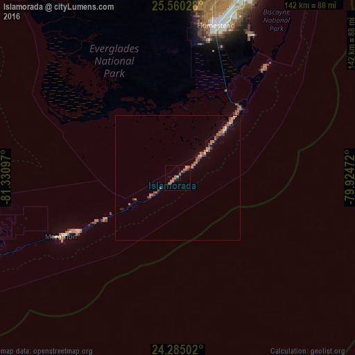
Analysis of Islamorada night lights 2016
Square area 10x10 km:
 0%
0%90-99
0%80-89
0%70-79
0.76%60-69
7.2%50-59
3.03%40-49
0%30-39
0.19%20-29
1.33%10-19
0.76%0-9
86.74%Square area 50x50 km:
0.05%90-99
0.05%80-89
0.12%70-79
0.12%60-69
1.16%50-59
0.47%40-49
0.41%30-39
0.21%20-29
0.16%10-19
0.15%0-9
97.12%Clear (daylight) street map image can be seen on geolist.org.
Map coordinates:
25° 33' 37" North, 81° 19' 51.5" West
24° 55' 27.5" North, 80° 37' 40.2" West
24° 17' 6.1" North, 79° 55' 29" West
Some cities around Islamorada sort by population:
• Homestead
62.4 km =38.8 mi,  14°
14°
• Leisure City
66.6 km =41.4 mi,  17°
17°
• Princeton
71.7 km =44.6 mi, 17°
• Florida City
60.1 km =37.3 mi, 14°
• Key Largo
25.6 km =15.9 mi,  45°
45°
• Goulds
75.1 km =46.7 mi, 19°
• Marathon
52.2 km =32.4 mi,  243°
243°
• Naranja
69.2 km =43 mi, 17°
4159839 (p: 7,131)
Sources (retrieved 2019-11-25):
» Earth at Night: Flat Maps 2012, 2016