Homestead night lights from space
Night Light of Homestead (Florida) from space (United States) Src. Average luminocity for 10x10km area is 75.0397% and for 50x50km: 21.9922%.
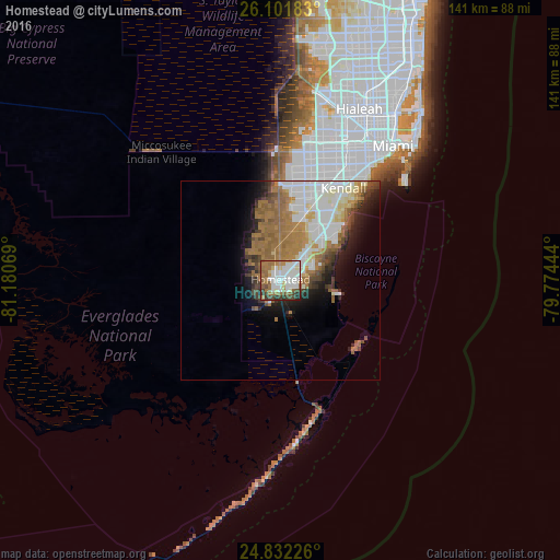
Analysis of Homestead night lights 2016
Square area 10x10 km:
 19.84%
90-99
23.61%80-89
6.75%70-79
2.18%60-69
20.24%50-59
9.72%40-49
8.33%30-39
5.36%20-29
3.97%10-19
0%0-9
0%Square area 50x50 km:
5.07%90-99
4.82%80-89
1.9%70-79
1.31%60-69
6.78%50-59
3.26%40-49
2.32%30-39
1.9%20-29
2.66%10-19
5.44%0-9
64.55%Clear (daylight) street map image can be seen on geolist.org.
Map coordinates:
26° 6' 6.6" North, 81° 10' 50.5" West
25° 28' 7.4" North, 80° 28' 39.2" West
24° 49' 56.1" North, 79° 46' 28" West
Some cities around Homestead sort by population:
• South Miami Heights
17.3 km =10.7 mi,  34°
34°
• Richmond West
16.5 km =10.3 mi,  16°
16°
• Cutler Ridge
18.1 km =11.2 mi,  46°
46°
• Leisure City
5.7 km =3.5 mi,  58°
58°
• Princeton
10.4 km =6.5 mi,  41°
41°
• Florida City
2.3 km =1.4 mi,  184°
184°
• Goulds
14.2 km =8.8 mi, 42°
• Naranja
7.8 km =4.8 mi, 44°
4159050 (p: 66,498)
Sources (retrieved 2019-11-25):
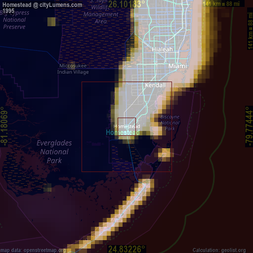
» NASA, Earths city lights 1995
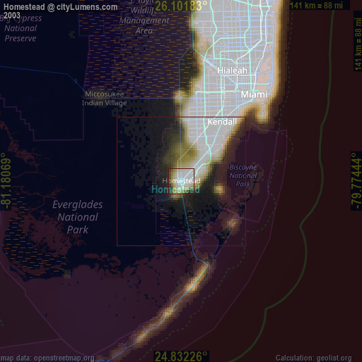
» NASA city lights 2003
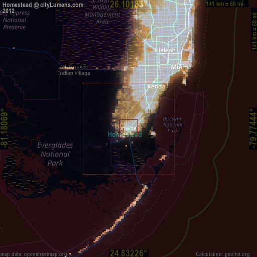
» Earth at Night: Flat Maps 2012, 2016